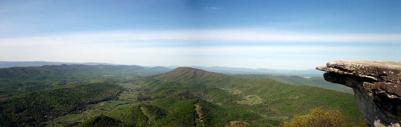
Beartown State Park
Photo: Wikimedia Commons
(CC via Wikimedia)
 LOWA Renegade EVO GTX MidGORE-TEX, 3 widths, resolableCheck price on Amazon →
 Hydro Flask Wide Mouth 32ozinsulated, durableCheck price on Amazon →
 Osprey Talon 22ventilated back, pole carryCheck price on Amazon →
 Adventure Medical Kits Ultralight Watertight .7day-hike specific, waterproofCheck price on Amazon →
 Black Diamond Spot 400-Rrechargeable, comfortableCheck price on Amazon →
Beartown State Park at a glance: A short boardwalk loop of about half a mile through a maze of massive sandstone boulders, deep crevices, and overhanging cliffs near Hillsboro, West Virginia. The walk is easy and family-friendly, but the appeal is the strange, cool-microclimate rock city rather than any distance or climb. The park is seasonal, so check that the gate is open before you go, and mind the boardwalk when it is wet, as the boards get genuinely slippery in rain.
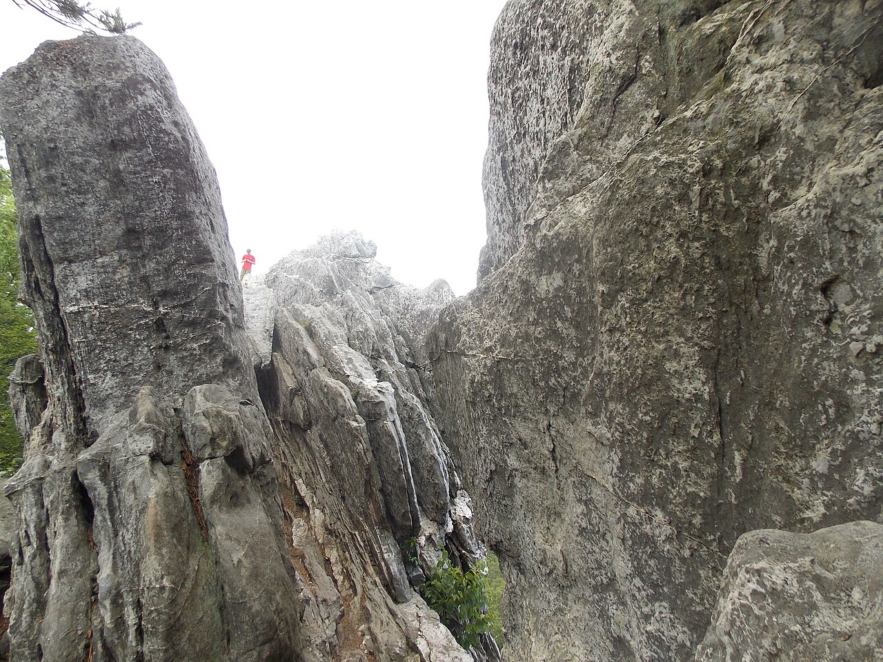
Beartown is one of those places where the reward has nothing to do with mileage. The entire trail is a half-mile boardwalk loop, yet it winds through a landscape unlike anywhere else in the region: towering blocks of Droop sandstone split by deep fissures, overhanging ledges, and shadowed passages that stay cool long after the surrounding forest has warmed up. Hikers consistently describe it as short but unforgettable, a compact geological wonder that earns its high ratings on character rather than length.
The boardwalk begins near the parking area and drops gently into the rock formations, carrying you on an elevated wooden path that threads between and beneath the boulders. This design is deliberate: the boardwalk protects a fragile environment while letting visitors get close to features that would otherwise be dangerous or impossible to reach. Along the loop you pass sheer rock walls, house-sized blocks, narrow crevices dropping into shadow, and overhangs pocked with weathering pits, all draped in moss and ferns in the damp, filtered light.
The name Beartown comes from those crevices and passages, which look like the kind of dens a bear might use, and the sense of walking through a hidden stone town is what stays with most visitors. Interpretive signs along the way explain how the formations came to be, turning the short loop into a small self-guided geology lesson. Because everything is close together, hikers report spending far longer than the eleven-minute average simply stopping to look into the fissures and up at the cliffs.
The microclimate is part of the experience. The deep, shaded crevices trap cold air, and it is common to find ice lingering in the shadows well into spring while the rest of the forest is green. That coolness makes Beartown a welcome stop on a hot summer day and adds to the otherworldly feel of the place.
The loop is easy, and the boardwalk makes it accessible to almost everyone, including families with young children and visitors who want a gentle, low-effort outing. There is no real climbing and very little elevation change, and the whole loop can be walked at a relaxed pace in well under half an hour if you are not stopping to explore.
The one genuine hazard is footing when the boards are wet. Hikers repeatedly warn that the boardwalk gets slippery in rain and can hold frost or ice in the cool crevices, so slow down and wear shoes with grip on damp days. Beyond that, the main thing to manage is expectation: this is a short interpretive walk, not a workout or a long hike, and visitors who arrive understanding that are the ones who leave impressed.
Beartown is best from spring through fall, roughly April through October, which also aligns with the park’s open season. Late spring is a favorite, when the surrounding forest greens up while ice still clings inside the deeper crevices, showing off the microclimate at its most striking. Summer is comfortable thanks to the natural cooling among the rocks, and fall adds color to the forest framing the formations.
Because Beartown is a seasonal day-use park, the access gate is typically closed in the winter months, so a cold-season visit is often not possible at all. That makes checking current park hours the single most important planning step, since a wasted drive to a locked gate is the most common frustration reported by would-be visitors. On wet days in any season, the slick boardwalk is the thing to plan around rather than the weather itself.
Confirm the park is open before you make the trip. Beartown keeps seasonal day-use hours and closes its gate in the off-season, so a quick check of current status saves a long drive to a closed park. The site has a parking area and restrooms, and dogs are welcome on leash, which makes it an easy family and pet stop once you know the gate is open.
There are no services within the small park itself, so bring water and anything you need, and note that cell service in this rural stretch of Pocahontas County can be spotty. The boardwalk is the only route through the formations, and stepping off it is both unsafe and damaging to the fragile environment, so the loop is designed to be enjoyed exactly as built. Give yourself more time than the half-mile suggests, because the looking is the point.
Beartown sits in a scenic corner of the state near Hillsboro and pairs well with nearby stops. Many visitors combine it with the historic Droop Mountain Battlefield State Park just up the road or the boardwalks and bogs of the Cranberry Glades, building a full day of short, distinctive walks rather than treating Beartown as an isolated quick stop.
Beartown earns enthusiastic reviews from nearly everyone who visits, with the overwhelming majority rating it a five-star stop and calling the rock formations well worth the detour. The recurring theme is surprise at how much wonder is packed into so short a walk, along with a steady chorus of practical advice: check that the park is open, and watch your footing on the boardwalk when it is wet.
That is the honest summary of Beartown. It is tiny, it is easy, and it is genuinely unlike anything else nearby, which is exactly why it rewards the trip. Time it for the open season and a dry day, take the boardwalk slowly, and this half-mile loop delivers a short walk you will remember far longer than its size suggests.
LOWA Renegade EVO GTX MidGORE-TEX, 3 widths, resolableCheck price on Amazon →Hydro Flask Wide Mouth 32ozinsulated, durableCheck price on Amazon →Osprey Talon 22ventilated back, pole carryCheck price on Amazon →Adventure Medical Kits Ultralight Watertight .7day-hike specific, waterproofCheck price on Amazon →Black Diamond Spot 400-Rrechargeable, comfortableCheck price on Amazon → Patagonia Torrentshell 3L Jacketdurable, trail + everydayCheck price on Amazon →
 Darn Tough Hiker Micro Crew Midweightlifetime warrantyCheck price on Amazon →
 Black Diamond Pursuit Trekking Polescork grip, lightweightCheck price on Amazon →
 Sawyer Squeeze Water Filterultralight, standard threadsCheck price on Amazon →
 Sawyer Premium Permethrin Insect Repellent Spraytreat clothing; kills ticksCheck price on Amazon →
 Mountain Hardwear Crater Lake Long Sleeve HoodyUPF 50, hood + thumb holesCheck price on Amazon →