I’ve driven from the city to every trailhead within two hours of the GW Bridge, and most of them within three. Some are worth the tolls and the traffic. A lot aren’t. Here are the 17 I keep going back to, and the ones I send people to when they ask me where to hike outside New York.
The trails are grouped by drive time from Midtown, cause that’s how everyone actually plans these days, myself included. Most of the distances work out about the same whether you’re coming from the city, northern Jersey, or Westchester.
Quick picks
Never hiked before? Start with High Point Monument or Ramapo Lake.
Bringing kids? High Point Monument, Ramapo Lake, or Kaaterskill Falls.
No car? Breakneck Ridge is on Metro-North (Breakneck Ridge stop, 75 min from Grand Central). Anthony’s Nose is reachable via the Manitou stop (70 min).
Inside the One-Hour Ring
Five trails here, all in North Jersey or right on the Hudson. None needs more than about 900 feet of climbing, yet every one of them feels much farther from the city than it is.
Pyramid Mountain is the closest real hike to the city that doesn’t feel like a city park, twenty-five minutes from the GW Bridge and you’re standing at a trailhead in Morris County. The highlight is Tripod Rock, a massive boulder balanced on three smaller stones that’s been sitting there since the last ice age, and every single group that reaches it takes the same photo of somebody pretending to hold it up. I have that photo too. The loop is around 3.5 miles with maybe 700 feet of gain and enough rock hopping to stay interesting, a good weekday-afternoon hike when you can’t commit to a full day. Gets icy in winter.
Ramapo Lake is in the same orbit, about 27 miles out via the Todd Trail loop. The lake sits in a hemlock-ringed bowl with rock outcrops rising on both sides. Five miles, 700ish feet of gain, plus the kind of quiet you forget exists this close to eight million people. The catch is the Skyline Drive lot, which fills by 9am on weekends from May through October and has been the subject of a personal grudge of mine for years. Go early or go on a Tuesday.
Stairway to Heaven on the AT in Wawayanda State Park earns its name: a steep 660-foot climb in under a mile, then a boardwalk across a ridgetop bog, then a rock ledge looking out over the Wallkill Valley toward the Catskills. Its 2.4 miles round trip, short and punchy. The view-to-effort ratio might be the best on this whole list. Muddy in spring, glowing in fall.
Terrace Pond sits on Bearfort Mountain about an hour out and almost nobody outside North Jersey knows it exists, which suits the people who do know just fine. The 4-mile loop crosses ridges of pink-purple puddingstone to a glacial pond ringed by cliffs, with genuinely hands-on scrambling in several spots that keeps the crowds thinner than the mileage suggests. Swimming is prohibited and the rangers do write tickets. Treat the pond as the view.
Anthony’s Nose hangs right over the Hudson at the Bear Mountain Bridge, about 42 minutes up the Palisades or a Metro-North ride to Manitou. Steep push through the woods, then a rock ledge with the river and the bridge below you, one of the best views in the Hudson Highlands for barely three miles of effort. There’s no official lot, so people park along Route 9D, where the situation gets a little more creative every year. Don’t block the road.
One to Two Hours Out: The Heavy Hitters
This ring holds the trails that made the list worth writing, Breakneck Ridge and Gertrude’s Nose in the Hudson Valley, plus the Delaware Water Gap cluster. This is where the terrain stops being a walk in the woods.
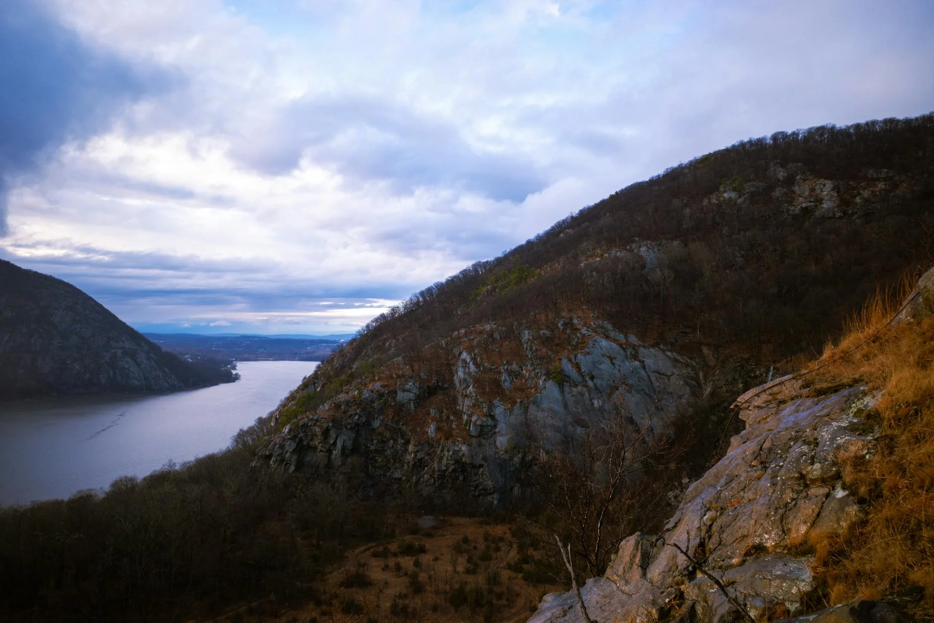
Breakneck Ridge is the one everyone knows, and for once the famous one deserves it. An hour north on Metro-North or 50 minutes by car, steep hand-over-hand scrambling starting basically at the trailhead, exposed rock the whole way up with the river below you. The loop runs about 3.7 miles and 1,250 feet, most of it in the first mile. I’ve done it maybe eight times now, the first time was a June morning years ago when I got off the train with a paper map like some kind of time traveler, and the opening scramble still gets my heart rate up every single time. Fall weekends are a zoo, that’s the honest price of it. Go midweek, or go at 7am, then walk into Cold Spring after and get in the bakery line with everyone else who had the same idea. It also anchors our list of the hardest hikes in New York, if you want to know what you’re graduating into. The scrambles are genuinely dangerous when icy, this is an April-through-November trail.
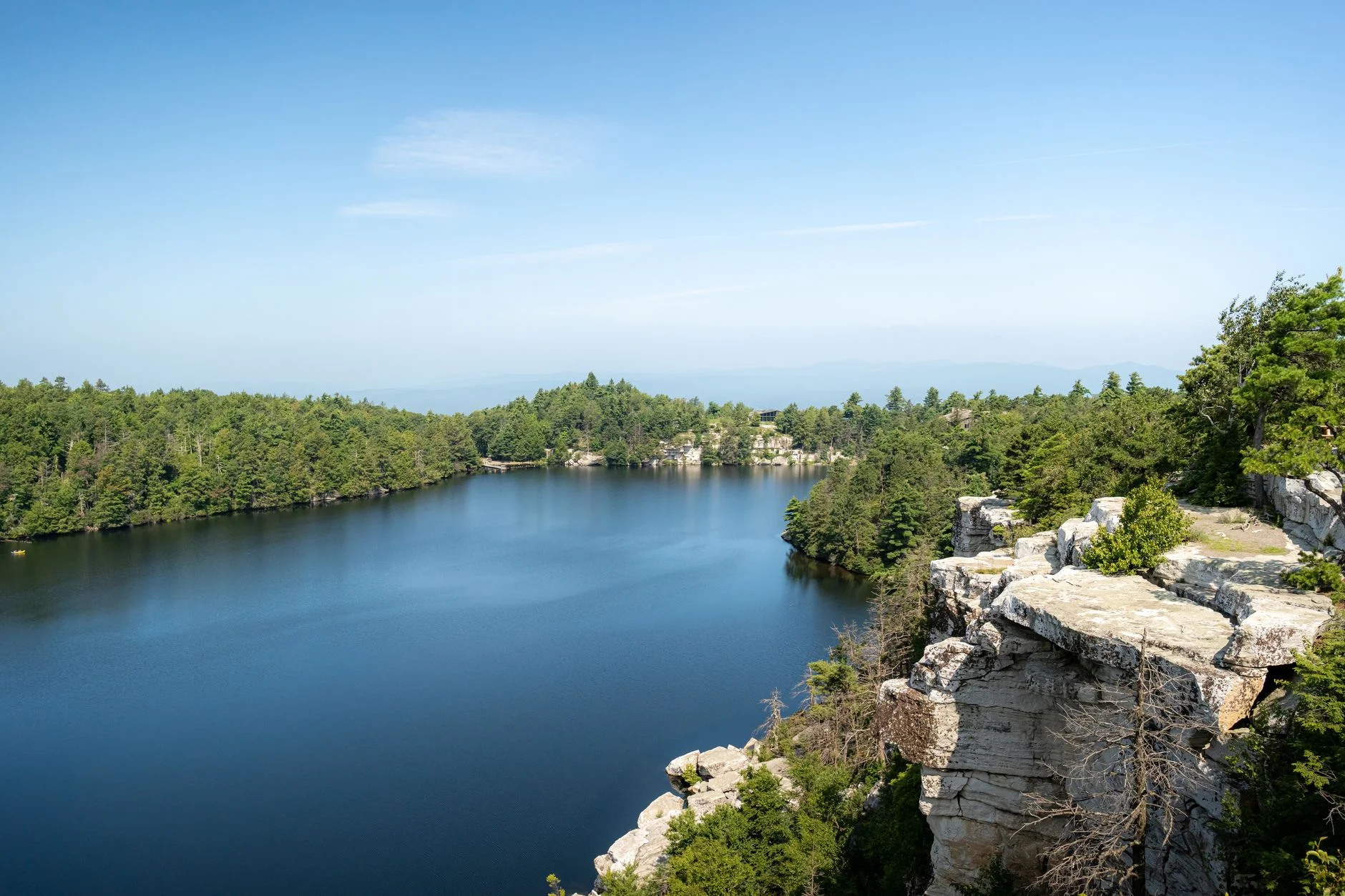
Gertrude’s Nose at Minnewaska is the best cliff-edge walking in the Hudson Valley and it baffles me how many city hikers still haven’t done it. The 7.5-mile loop follows white quartz conglomerate ledges along the rim of the Palmaghatt Ravine, long stretches where the Shawangunk cliffs drop away just off your boot, and the gain is a spread-out 1,050 feet so the difficulty is exposure and distance rather than climbing. The day-use lot fills by mid-morning on weekends and the park caps entries once it does, which I learned the hard way one October Saturday from the wrong side of the gate.
Mount Tammany at the Delaware Water Gap is an hour out via I-80, and I remain convinced most New Yorkers have driven past this exit a hundred times without knowing what’s up there. The Red Dot Trail is a relentless boulder grind, 4.3 miles and about 1,200 feet, ending at a clifftop where the Gap and the river open up 1,200 feet below you. Mount Minsi sits directly across the river on the Pennsylvania side, same elevation, more forest, fewer people. Tammany for the view, Minsi for the breathing room.
Sunfish Pond is the other half of a Water Gap day, a glacial lake at 1,382 feet on the Kittatinny Ridge, one of the southernmost glacial ponds in the country, reached by an 8.6-mile round trip on the AT from Dunnfield Creek. The pond is eerie in the best way. Dark water, rhododendron and hemlock all around, no development anywhere and no noise either. I go back every couple years and it has never once failed to deliver, which is a thing I can say about very few places and zero restaurants.
High Point Monument and Buttermilk Falls pair naturally in the state’s far northwest corner, ten minutes apart. High Point is New Jersey’s roof at 1,803 feet, a gentle 3.5-mile round trip to a stone obelisk with three states spread out around it, the easiest genuinely-rewarding hike on this page and the one I hand to visiting parents. Buttermilk is the state’s tallest waterfall — the height you’ll see quoted runs anywhere from 85 to 200 feet depending on how much of the cascade the person doing the quoting decided to count, which tells you something about waterfall measurement as a discipline. The climb beside it is steep and the wet stone steps demand respect. Spring snowmelt is when the falls actually roar.
The Catskills Ring
If you have a full day and don’t mind the Thruway, the Catskills are the best mountains-per-gallon from the city. Real elevation and actual wilderness, somehow still under three hours from Times Square. Our full guide to the best hikes in the Catskills covers 15 trails; these four are the right entry points.
Giant Ledge is my standing recommendation for a first Catskills hike, 4 miles round trip, 1,400 feet, a rooty forested climb to a series of rock ledges that look south over Slide Mountain and the whole escarpment. Last October Saturday I was up there, the ledges were shoulder to shoulder. On a Wednesday you might have them alone. It shares a trailhead with Slide if you want to build a bigger day.
Slide Mountain is the range’s highest peak at 4,180 feet, about 6 miles and 1,700 feet from the usual trailhead. I’ll be straight about this one: the summit is forested with no open view, the good viewpoint is partway up, and for years I told people to skip it in favor of Giant Ledge. I’ve softened on that, partly because the quiet up top grew on me and partly because everyone working the Catskill 3500 list starts here anyway, so my objection was mostly me arguing with a checklist. Snow holds into April up high.
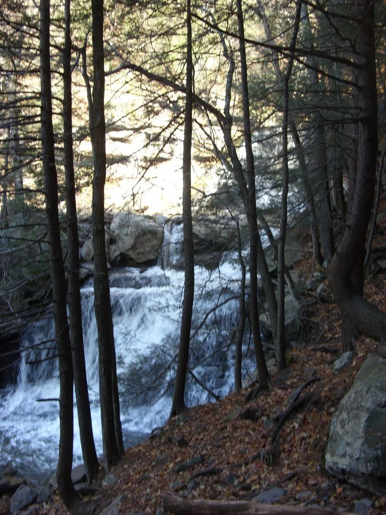
Kaaterskill Falls is the Catskills’ most famous waterfall, a 260-foot two-tier cascade that Hudson River School painters were setting up easels at in the 1820s. The trail from Route 23A is short but steep and rocky, 1.4 miles round trip. Go in spring or right after a big rain, cause by midsummer it can thin to a trickle and you’ll stand at the viewing platform doing the mental math on your gas money. It earns its spot on our best waterfall hikes on the East Coast list too.
Overlook Mountain near Woodstock is a 4.9-mile round trip up a wide gravel road to a fire tower with 360-degree views, and the ruins of the old Overlook Mountain House hotel sitting halfway up, slowly being eaten by the forest. The road itself is monotonous, I won’t pretend otherwise, but between the ruins and the tower the payoff column wins. If summit towers are your thing, the fire tower hikes roundup maps out fifteen more.
The Long Hauls
Two more at the far edge of day-trip range, both better as the centerpiece of a full Taconics-or-Berkshires day than as a quick out-and-back. Bear Mountain (the Connecticut one, not Harriman’s) is the state’s highest summit at 2,316 feet, a rocky 6.4-mile AT loop about 94 miles from the city, proper New England hiking that most NYC hikers skip because they default to the Catskills. And Bash Bish Falls on the New York–Massachusetts line is the kind of place that makes you stop talking when you round the corner, an 80-foot fall into a pool ringed by sheer rock. The New York approach is a steep 0.6 miles; there’s a gentler Massachusetts side I still haven’t used, every trip I tell myself this is the time and every trip I default to the short way. No swimming, and they mean it. People have died here.
Can You Hike Near NYC Without a Car?
Yes. Metro-North’s Hudson Line reaches two of the best trailheads on this list directly: Breakneck Ridge has its own stop 75 minutes from Grand Central, and Anthony’s Nose is a short walk from the Manitou stop. No rideshare required for either.
Breakneck Ridge — Metro-North to the Breakneck Ridge stop, weekend and holiday service only, trailhead right at the station. Return the same way, or hike south to Cold Spring station for more frequent trains and a main street with restaurants.
Anthony’s Nose — Metro-North to Manitou, 70 minutes, a 10-minute walk to the Route 9D trailhead. Also weekend-only. The Peekskill station has daily service and it’s a $10 taxi from the same trailhead. Whether the weekend-only stops survive the next MTA schedule shakeup is an open question I check every spring, the railroad does not consult me.
For everything else, NJ Transit buses technically reach some North Jersey trailheads but the service is thin, a rental or a rideshare split is more practical for the Water Gap and the Catskills. If you’re limited to shorter car-free outings, our guide to the best 5-mile hikes near NYC is built around exactly that constraint.
How Do the Best Hikes Near NYC Compare?
| Trail | Drive From Midtown | Miles | Elev. Gain | Difficulty |
|---|---|---|---|---|
| Pyramid Mountain | 25 min | 3.5 | 700 ft | Moderate |
| Ramapo Lake | 30 min | 5.0 | 700 ft | Moderate |
| Anthony’s Nose | 42 min (or Metro-North) | 3.0 | 900 ft | Moderate |
| Stairway to Heaven | 45 min | 2.4 | 660 ft | Moderate |
| Breakneck Ridge | 50 min (or Metro-North) | 3.7 | 1,250 ft | Strenuous |
| Terrace Pond | 1 hr | 4.0 | 900 ft | Strenuous |
| Mount Tammany | 1 hr | 4.3 | 1,193 ft | Strenuous |
| High Point Monument | 1 hr 10 min | 3.5 | 400 ft | Easy |
| Buttermilk Falls | 1 hr 10 min | 5.0 | 1,600 ft | Strenuous |
| Sunfish Pond | 1 hr 15 min | 8.6 | 1,250 ft | Moderate |
| Gertrude’s Nose | 1 hr 30 min | 7.5 | 1,050 ft | Moderate |
| Giant Ledge | 1 hr 45 min | 4.0 | 1,400 ft | Strenuous |
| Slide Mountain | 1 hr 45 min | 6.0 | 1,700 ft | Moderate |
| Overlook Mountain | 1 hr 50 min | 4.9 | 1,400 ft | Moderate |
| Bear Mountain CT | 1 hr 50 min | 6.4 | 1,550 ft | Strenuous |
| Kaaterskill Falls | 2 hr | 1.4 | 591 ft | Strenuous |
| Bash Bish Falls | 2 hr | 0.6 | 300 ft | Easy |
Picking Your First One, and When to Go
If you only do one: Breakneck Ridge. If you want a waterfall, Kaaterskill Falls in spring. Solitude, Sunfish Pond on a weekday. Cliff-edge drama without a hard climb, Gertrude’s Nose. Bringing someone who doesn’t hike much, High Point Monument. Best view for minimal effort, Stairway to Heaven. And if you have a full day and a tolerance for the Thruway, Giant Ledge.
Broad pattern: the Hudson Valley trails (Breakneck, Anthony’s Nose, Stairway to Heaven) are the easiest to reach and the most crowded, and the Catskills trade a longer drive for bigger mountains and fewer people. The Water Gap cluster is the arbitrage play, the most underrated destination inside two hours.
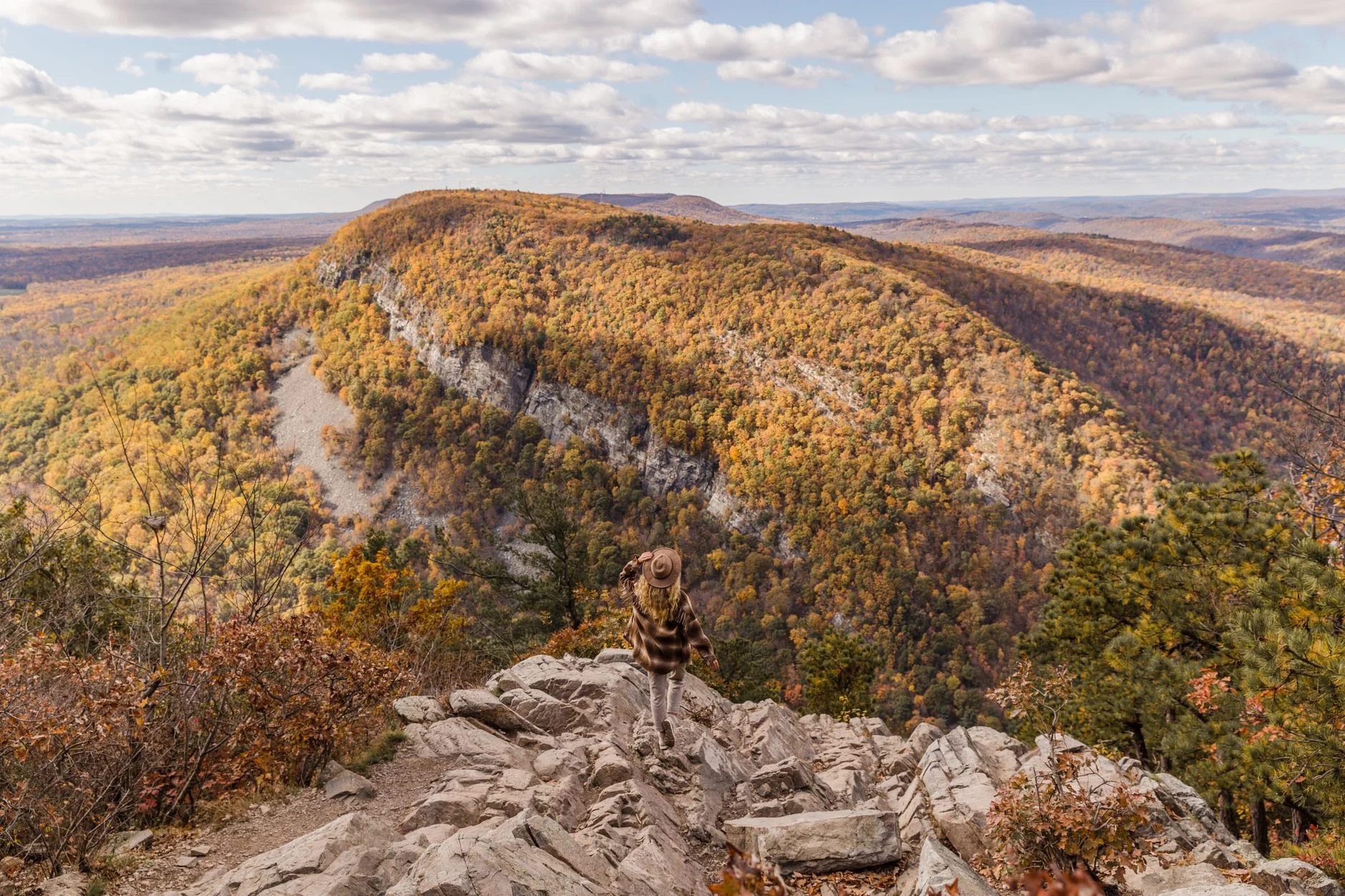
Timing: early October through early November is the window, peak foliage rolls south from the Catskills into the Highlands over those weeks with the humidity finally gone, and everyone knows it, so weekdays pay double. Spring belongs to the waterfalls. Summer is for the shady water trails, Sunfish Pond and Ramapo Lake, or the swimming hole hikes further out. Winter takes the scrambles off the table without traction gear but leaves High Point and Ramapo honest options. And in every season, the real gatekeeper on this entire list is parking, be there before 9 on a weekend or bring a book.
For trips beyond day-trip range, our guide to the best hikes on the East Coast is the long-weekend planning list.



Frequently Asked Questions
What is the best hike near New York City?
Breakneck Ridge in the Hudson Highlands is the most popular day hike from NYC. The scramble up exposed rock with Hudson River views is dramatic, and it is accessible by Metro-North train from Grand Central. Harriman State Park and the Catskills offer more options within two hours.
Can you hike from NYC without a car?
Yes. Breakneck Ridge and Cold Spring are accessible via Metro-North. Harriman State Park has trailheads near the Tuxedo train station. Bear Mountain is reachable by bus. The Palisades Interstate Park in New Jersey is a short bus ride from the George Washington Bridge.
What are the best hikes in the Catskills near NYC?
Kaaterskill Falls and Slide Mountain are the two essential Catskill hikes. Kaaterskill is a short walk to a 260-foot two-tiered waterfall. Slide Mountain is the highest peak in the Catskills with views across the range. Both are about 2 to 2.5 hours from Manhattan.
What is the hardest hike near NYC?
Breakneck Ridge is the hardest popular hike near NYC. Steep hand-over-hand scrambling starts at the trailhead and the 3.7-mile loop gains 1,250 feet, most of it in the first mile. For a bigger test, Devil's Path in the Catskills is widely considered the hardest day hike in the Northeast.
Are there waterfall hikes near NYC?
Yes. Kaaterskill Falls in the Catskills is the tallest at 260 feet, about two hours from the city. Buttermilk Falls in Stokes State Forest (200 feet) and Bash Bish Falls on the New York-Massachusetts border (80 feet) round out the best options. All three run strongest in spring on snowmelt.
When is the best time to hike near NYC?
Early October through early November is the best window, with peak foliage and low humidity. Spring is best for waterfalls. On weekends year-round, arrive before 9am; parking at popular trailheads like Breakneck Ridge and Minnewaska fills by mid-morning.