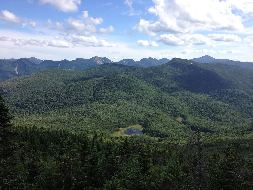
Constitutional Marsh
Photo: Wikimedia Commons
(CC via Wikimedia)
 LOWA Renegade EVO GTX MidGORE-TEX, 3 widths, resolableCheck price on Amazon →
 Hydro Flask Wide Mouth 32ozinsulated, durableCheck price on Amazon →
 Osprey Talon 22ventilated back, pole carryCheck price on Amazon →
 Adventure Medical Kits Ultralight Watertight .7day-hike specific, waterproofCheck price on Amazon →
 Black Diamond Spot 400-Rrechargeable, comfortableCheck price on Amazon →
Constitution Marsh at a glance: A 2.5-mile round trip through Constitution Marsh Wildlife Sanctuary in Cold Spring, NY, combining a woodland walk from Boscobel House Gardens, a short road section, and a boardwalk into the Hudson River tidal marsh. Easy by trail rating, with dramatic views west to Storm King Mountain across the river. Better as birding than as hiking; not dog-friendly, not ADA-accessible.
Constitution Marsh, also written locally as “Constitutional Marsh,” is one of the more unusual Hudson Highlands hikes. The Audubon Society sanctuary in Cold Spring covers a Hudson River tidal marsh with a short boardwalk into cattail wetlands, and the walk to reach it combines forest, paved road, and river-edge terrain that most Hudson Highlands trails do not offer. The view from the boardwalk west across the river to Storm King Mountain is the destination.
The route starts at Boscobel House and Gardens on Route 9D, not at the Audubon Center itself. Constitution Marsh Sanctuary has no dedicated public parking, so visitors park at Boscobel (which charges a day-use fee for grounds access) and pick up the green-blazed Woodland Trail from there. The Woodland Trail winds through hardwood forest along the Hudson bluff for about half a mile before connecting to the blue-blazed trail down to the Audubon Center.
The connector section is the surprise of the route. A paved access road drops steeply for about half a mile on the descent to the Audubon Center, with the corresponding climb on the return. Hikers regularly describe this section as the hardest part of the walk despite the paved surface. The grade is steep enough that visitors with mobility issues or with very small children may want to turn back at the road rather than commit to the descent.
The Audubon Center is the sanctuary’s small headquarters at the water’s edge, with exhibits about the marsh ecology and a short trail through cattails to a viewing boardwalk. The boardwalk extends into the tidal marsh proper, giving a view across the Hudson to Storm King Mountain and up-river toward Breakneck Ridge. Water levels change with the tide, and the visual impression of the boardwalk changes accordingly.
Easy by any measure of a trail, with the caveat that the road section between the Woodland Trail and the Audubon Center is steep enough to genuinely surprise casual visitors. The 2.5-mile round trip stays under 200 feet of total elevation change, concentrated in that road segment. Most casual walkers complete the loop in about 2 hours, including time on the boardwalk and at the exhibits.
The trail is not suitable for strollers, and the Audubon Center notes that dogs are not welcome on the sanctuary trails. Wheelchair access is not provided anywhere on the route. Hikers with birding interests should plan an unhurried pace with time at the exhibits and the boardwalk; the destination is more the point than the mileage.
Spring, mid-April through late May, is the standout window for birding. Warbler migration peaks through May, with the marsh serving as a rest stop for migrating songbirds and shorebirds. Great blue herons and ospreys nest in the marsh area, and the boardwalk becomes the best public vantage in the sanctuary during breeding season.
Fall (mid-September through early November) brings the hawk migration along the Hudson River corridor and waterfowl gathering in the marsh before winter. The boardwalk view of the marsh in fall color, with Storm King Mountain rising across the river in peak red and gold, is the photographic payoff for a return visit. Summer works but the marsh gets buggy, and high tide during summer visits reduces the wading-bird activity that spring visitors expect.
Winter visits are quieter, with the sanctuary open year-round but the wildlife activity dropping significantly. The boardwalk itself can close for weather, so confirm with the Audubon Center before driving up in cold conditions.
Boscobel House and Gardens charges a day-use grounds fee. Confirm current pricing before the visit; the sanctuary is accessible only through the Boscobel grounds during standard hours. The Audubon Center itself is free once accessed via the Woodland Trail. Bathrooms are at Boscobel and at the Audubon Center; nothing on the trail between.
Cold Spring village is a ten-minute drive south of Boscobel with restaurants, coffee, and the Metro-North train station. The Hudson Line runs directly from Grand Central to Cold Spring, which makes the sanctuary among the more accessible Hudson Highlands destinations for hikers without cars. Walking from the Cold Spring station to Boscobel is possible but adds about 3 miles to the day, mostly along the road; most visitors take a short taxi or rideshare from the station.
The sanctuary is closed on some weekdays and has limited seasonal hours. Confirm current opening times with the Audubon Center before planning a specific date. Kayak tours of the marsh run seasonally through the Audubon Society and provide a different vantage than the trail-and-boardwalk approach.
Constitution Marsh is the Hudson Highlands visit for hikers who prefer birding to peak-bagging. Hikers consistently describe the boardwalk view across the river to Storm King Mountain as the standout, with the contrast between the flat tidal marsh in the foreground and the Highlands ridges rising across the water providing a landscape combination that few other Hudson Valley destinations offer. The route feels short but rewards the effort of the road-section climb with a distinctive marsh boardwalk experience.
The sanctuary also anchors the small Hudson Highlands ecosystem of Audubon and land trust destinations that thread through the Cold Spring area. Manitoga (the Russel Wright Design Center), Boscobel House, and the historic Bear Mountain Bridge area to the south all combine with Constitution Marsh into a full Hudson Highlands weekend that mixes hiking, birding, and Hudson River history. For visitors taking Metro-North from New York City for a day trip, Constitution Marsh is the sanctuary that pairs naturally with lunch in Cold Spring and a return train.
LOWA Renegade EVO GTX MidGORE-TEX, 3 widths, resolableCheck price on Amazon →Hydro Flask Wide Mouth 32ozinsulated, durableCheck price on Amazon →Osprey Talon 22ventilated back, pole carryCheck price on Amazon →Adventure Medical Kits Ultralight Watertight .7day-hike specific, waterproofCheck price on Amazon →Black Diamond Spot 400-Rrechargeable, comfortableCheck price on Amazon → Patagonia Torrentshell 3L Jacketdurable, trail + everydayCheck price on Amazon →
 Darn Tough Hiker Micro Crew Midweightlifetime warrantyCheck price on Amazon →
 Black Diamond Pursuit Trekking Polescork grip, lightweightCheck price on Amazon →
 Sawyer Squeeze Water Filterultralight, standard threadsCheck price on Amazon →