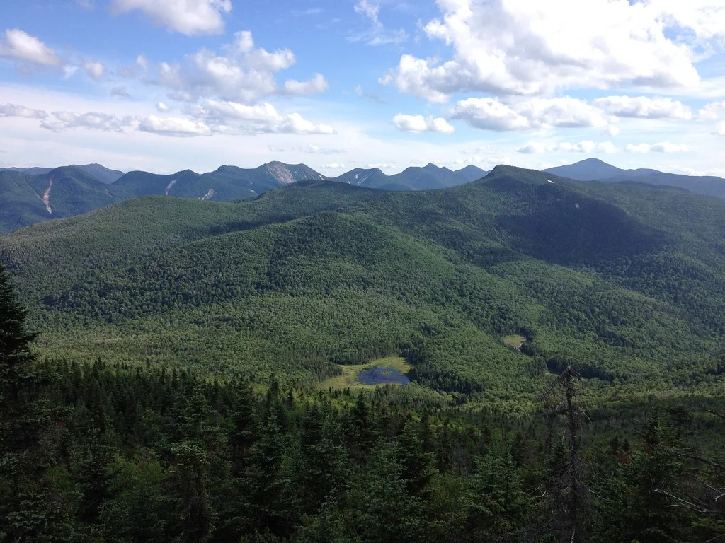
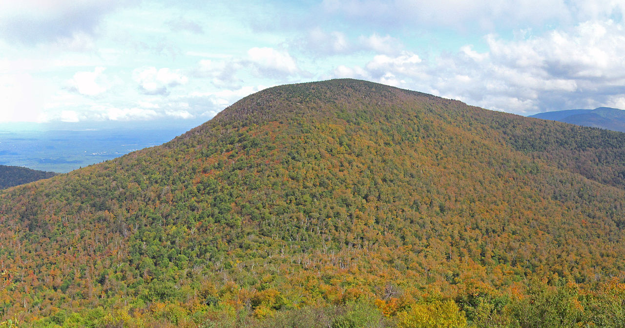
Crane Mountain — Adirondack Mountains
Photo: Verplanck Colvin
(CC via Wikimedia)
 LOWA Renegade EVO GTX MidGORE-TEX, 3 widths, resolableCheck price on Amazon →
 Hydro Flask Wide Mouth 32ozinsulated, durableCheck price on Amazon →
 Osprey Talon 22ventilated back, pole carryCheck price on Amazon →
 Adventure Medical Kits Ultralight Watertight .7day-hike specific, waterproofCheck price on Amazon →
 Black Diamond Spot 400-Rrechargeable, comfortableCheck price on Amazon →
Crane Mountain at a glance: A 3.5-mile loop in the southern Adirondacks that packs steep rock scrambles, bolted wooden ladders, and a scenic mountain pond into a short but demanding hike. Rated challenging, and the reason is the terrain rather than the distance: this little loop climbs hard and gets hands-on. The summit and the pond both reward the effort, so wear grippy shoes, take the ladders carefully, and give yourself more time than the mileage suggests.
Crane Mountain is proof that a short hike can be a big adventure. This 3.5-mile loop near Thurman climbs steeply to a summit with sweeping southern Adirondack views, using rock scrambles and fixed wooden ladders to get up the mountain’s rugged flanks. A pretty mountain pond partway around adds a second highlight, and the combination of steep scrambling and scenery makes Crane a local favorite that hikers consistently describe as tougher and more fun than its modest length implies.
The loop wastes no time getting steep. Almost from the start, the trail climbs hard over rock, and in the steepest spots it uses sturdy wooden ladders bolted to the rock to get hikers up pitches that would otherwise require real climbing. These ladders are the signature feature of Crane Mountain, and they turn the ascent into a genuine hands-on adventure that stands out among Adirondack hikes.
The summit rewards the scrambling with open rock ledges and wide views across the southern Adirondacks, a big payoff for such a short climb. From the top, the loop descends toward Crane Mountain Pond, a scenic tarn tucked below the summit that is a favorite spot to rest and even swim on a warm day. The pond is stocked and draws anglers as well, and its quiet setting below the cliffs feels far removed from the steep climb just above. The pond gives the loop a second destination and a change of pace from the steep summit rock.
The rest of the loop closes the circuit back to the trailhead, with more rocky footing along the way. Trail markers guide the route, but the network can be briefly confusing at junctions, so paying attention to the markers and a map helps you stay on the intended loop. The mix of steep scrambles, ladders, a summit, and a pond packs a lot of variety into a small area.
Challenging is the right call despite the short distance, and the difficulty is all about the terrain. The loop climbs steeply and relentlessly, with rock scrambles and ladders that demand the use of your hands and careful footing, so it is far more strenuous than 3.5 miles suggests. Most hikers take somewhere around three to four hours for the full loop, more than the mileage alone would imply.
Conditions raise the stakes on the rock. The scrambles and ladders become slick and more hazardous when wet, and mud is common after rain, so dry conditions make a real difference in both safety and enjoyment. The steep terrain is also hard on the knees on the descent. The honest read is a short but genuinely demanding hike whose ladders and scrambles reward the prepared and punish the careless.
The prime window is May through October, when the rock is most reliably dry and the pond is at its most inviting. Summer is popular, and the pond makes a refreshing reward on a warm day, while fall pairs the summit views with color across the southern Adirondacks. Late spring greens up the forest but can leave the rock wet and the trail muddy.
Winter turns the ladders and scrambles into serious, icy obstacles best left to experienced, well-equipped hikers, and the steep terrain is genuinely hazardous when frozen. Snow and ice can linger into spring on the shaded rock. In any season, dry conditions on the scrambles and ladders are what make Crane both safest and most enjoyable, so timing the hike for good weather pays off.
Parking is at the Crane Mountain trailhead near Thurman, a free lot of moderate size that fills on nice weekends, so an early arrival helps. There are no services at the trailhead, so bring water and anything you need, and there is no reliable water source on the climb aside from the pond, which should be treated before drinking.
Sturdy footwear with good grip is essential for the scrambles and ladders, and it is wise to keep your hands free on the steep rock rather than carrying trekking poles deployed. The ladders are demanding for dogs and not every dog is suited to them, so consider the terrain before bringing a pet, and keep dogs leashed. Give yourself plenty of daylight given how much the scrambling slows the pace.
Crane Mountain sits in the southern Adirondacks near Thurman, within reach of the Glens Falls and Lake George areas, which makes it an accessible adventure rather than a remote trek. Its blend of steep scrambling, fixed ladders, a rewarding summit, and a scenic pond makes it a standout short hike that punches well above its distance. Few hikes anywhere pack this much vertical adventure into so short a loop.
Crane Mountain earns strong marks from the people who hike it, with the large majority rating it a rewarding challenge and pointing to the ladders, the summit views, and the pond as the highlights. The recurring practical notes are consistent: the loop is steep and hands-on, the ladders and scrambles are the crux, and dry conditions make a real difference on the rock.
That is the honest read on this southern Adirondack gem. It is short, steep, and genuinely adventurous, with ladders and scrambles that set it apart and a scenic pond that rewards the climb. Wear grippy shoes, take the ladders carefully, and save it for a dry day, and Crane Mountain delivers far more adventure than its 3.5 miles would ever suggest.
LOWA Renegade EVO GTX MidGORE-TEX, 3 widths, resolableCheck price on Amazon →Hydro Flask Wide Mouth 32ozinsulated, durableCheck price on Amazon →Osprey Talon 22ventilated back, pole carryCheck price on Amazon →Adventure Medical Kits Ultralight Watertight .7day-hike specific, waterproofCheck price on Amazon →Black Diamond Spot 400-Rrechargeable, comfortableCheck price on Amazon → Patagonia Torrentshell 3L Jacketdurable, trail + everydayCheck price on Amazon →
 Darn Tough Hiker Micro Crew Midweightlifetime warrantyCheck price on Amazon →
 Black Diamond Pursuit Trekking Polescork grip, lightweightCheck price on Amazon →
 Sawyer Squeeze Water Filterultralight, standard threadsCheck price on Amazon →