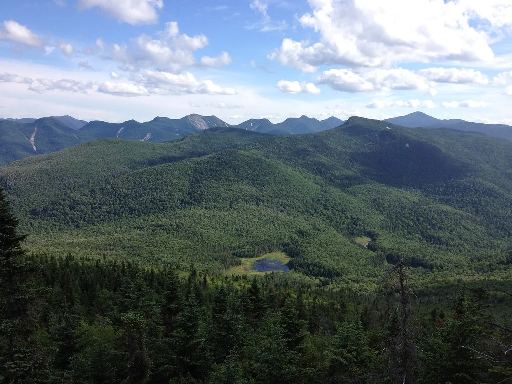
Saint Regis Fire Tower — Adirondack Mountains
Photo: John Sweeney
(CC via Wikimedia)
 LOWA Renegade EVO GTX MidGORE-TEX, 3 widths, resolableCheck price on Amazon →
 Hydro Flask Wide Mouth 32ozinsulated, durableCheck price on Amazon →
 Osprey Talon 22ventilated back, pole carryCheck price on Amazon →
 Adventure Medical Kits Ultralight Watertight .7day-hike specific, waterproofCheck price on Amazon →
 Black Diamond Spot 400-Rrechargeable, comfortableCheck price on Amazon →
Saint Regis Mountain at a glance: A 6.6-mile out-and-back in the northern Adirondacks to a restored summit fire tower with a 360-degree view over the lake-dotted St. Regis Canoe Area. Rated moderate, with an easy start that gives way to a steep final mile. The lower trail is famously muddy, bugs are fierce in early summer, and the fire tower is the payoff, so bring bug spray and dry-footed footwear.
Saint Regis Mountain is a classic Adirondack fire-tower hike near Paul Smiths, delivering a panoramic reward for a moderate climb through northern forest. The restored steel tower at the summit opens up a sweeping view across the St. Regis Canoe Area, a maze of ponds and lakes scattered through the surrounding wilderness. Reviews rate it highly for that payoff, with two consistent themes running through nearly every trip report: the lower trail is a mud pit much of the year, and the climb saves its real work for the final mile.
The hike begins gently, following a well-trodden path through mixed hardwood and conifer forest that gains elevation slowly for its first couple of miles. This lower section is easy walking, and it lulls hikers into a comfortable rhythm before the trail turns serious. The forest is pleasant and shady, and glimpses of the terrain ahead build anticipation for the summit.
The last mile is where the effort concentrates. The trail steepens noticeably, climbing more directly toward the summit over rockier ground, and this is the stretch that has hikers working. It is not a technical scramble, but it is a sustained, steep push that earns the summit and slows the pace considerably after the easy start.
The reward is the restored fire tower at the top. Climbing its steps opens a full 360-degree panorama, with the countless ponds of the St. Regis Canoe Area glinting below and the peaks of the northern Adirondacks ranged around the horizon. The tower fell out of official use decades ago and was restored by volunteers, reopening to hikers as a summit landmark rather than a working lookout. Hikers consistently single out the tower and its view as the highlight, and many linger at the summit far longer than the climb alone would suggest.
Moderate is a fair rating, and the difficulty is unevenly spread. The bulk of the trail is easy to moderate walking, so the steep final mile is what defines the effort, and hikers who pace themselves handle it comfortably. Most people complete the round trip in around three to four hours depending on time spent enjoying the tower.
The bigger factor for most visitors is the mud. The lower trail holds water and churns into long muddy stretches through much of the year, and it is the single most common complaint in reviews, so waterproof footwear makes a real difference. Bugs are heavy in early summer, snow and ice linger into spring on the upper trail, and the summit can be cool and breezy. None of this is dangerous, but planning around the mud and bugs is what separates a pleasant hike from a slog.
The trail is open year-round and popular in every season, including winter when snowshoers make the climb. Late summer and fall are the most comfortable times, once the worst of the bugs have eased and the trail has had a chance to dry, with autumn adding color across the lakes region from the tower. Early summer brings green forest but also peak bug season and lingering mud.
Winter turns the hike into a snowshoe or microspike outing, quieter and often stunning under snow, though it demands the right traction and layers for the exposed summit. Spring is the muddiest and buggiest stretch, so many hikers wait for drier conditions. Whatever the season, a clear day is what makes the summit view pay off, since the panorama of ponds and peaks is the whole point of the climb.
Parking is at the trailhead near Paul Smiths, a free lot of moderate size that fills on nice weekends, so an early arrival helps. There are no services at the trailhead, so bring water and anything you need for the hike, and there is no reliable water once you start climbing.
Bug protection is the most-recommended item in the warmer months, and waterproof boots handle the pervasive mud on the lower trail. Dogs are welcome and may be off-leash in some areas, which makes this a favorite among Adirondack dog owners. Carry a layer for the breezy summit, and mind your footing on the steep final mile, which can be slick when wet or muddy.
Saint Regis Mountain sits in the northern Adirondacks near Paul Smiths and the St. Regis Canoe Area, a region defined by its water as much as its mountains. That setting is exactly what makes the summit view so distinctive, and the hike pairs naturally with paddling or exploring the surrounding lakes for a fuller Adirondack trip. The nearby Paul Smith’s College visitor center adds gentle trails and exhibits that make an easy complement to the climb.
Saint Regis earns strong marks from the many people who hike it, with the large majority rating the tower view well worth the climb and singling out the panorama over the lakes as the highlight. The recurring practical advice is remarkably consistent: expect deep mud on the lower trail, bring bug spray in summer, and save energy for the steep final mile.
That is the fair summary of this northern Adirondack classic. It offers a moderate climb to a restored fire tower with a genuinely spectacular view over a wilderness of ponds and peaks, which is exactly why it stays so popular. Wear waterproof boots, pack bug protection, and time it for a clear, drier day, and Saint Regis rewards the effort with one of the finest fire-tower views in the Adirondacks.
LOWA Renegade EVO GTX MidGORE-TEX, 3 widths, resolableCheck price on Amazon →Hydro Flask Wide Mouth 32ozinsulated, durableCheck price on Amazon →Osprey Talon 22ventilated back, pole carryCheck price on Amazon →Adventure Medical Kits Ultralight Watertight .7day-hike specific, waterproofCheck price on Amazon →Black Diamond Spot 400-Rrechargeable, comfortableCheck price on Amazon → Patagonia Torrentshell 3L Jacketdurable, trail + everydayCheck price on Amazon →
 Darn Tough Hiker Micro Crew Midweightlifetime warrantyCheck price on Amazon →
 Black Diamond Pursuit Trekking Polescork grip, lightweightCheck price on Amazon →
 Sawyer Squeeze Water Filterultralight, standard threadsCheck price on Amazon →