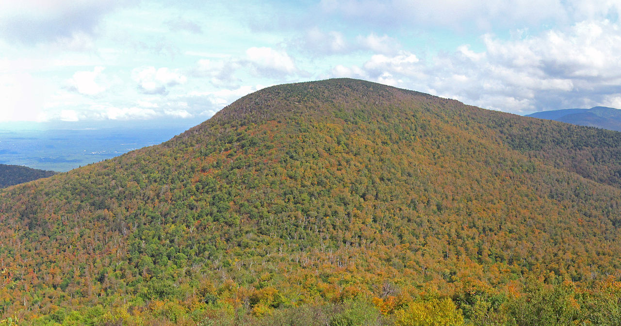
North Point at North-South Lake — Catskill Mountains
Photo: Bryant, William Cullen, 1794-1878, editor
Bunce, Oliver Bell, 1828-1890
(CC via Wikimedia)
 LOWA Renegade EVO GTX MidGORE-TEX, 3 widths, resolableCheck price on Amazon →
 Hydro Flask Wide Mouth 32ozinsulated, durableCheck price on Amazon →
 Osprey Talon 22ventilated back, pole carryCheck price on Amazon →
 Adventure Medical Kits Ultralight Watertight .7day-hike specific, waterproofCheck price on Amazon →
 Black Diamond Spot 400-Rrechargeable, comfortableCheck price on Amazon →
North-South Lake is the largest campground in the Catskill Park, and the trailhead for North Point sits at the edge of the escarpment — the long cliff face that marks the eastern edge of the Catskill Plateau. The trail heads north along this escarpment, following the cliff edge with the Hudson Valley 2,000 feet below on your right.
The views begin almost immediately. Unlike most Catskill hikes where you climb for an hour before seeing anything, the escarpment trail delivers panoramic eastern views within the first half mile. You can see the Hudson River, the Taconic Range, and on clear days the Berkshires beyond. The trail passes multiple named overlooks — Artist’s Rock, Sunset Rock, and Newman’s Ledge — each with a slightly different angle on the valley below.
North Point itself is the turnaround for most day hikers. The point is a rocky overlook with views north toward the Blackhead Range and the northern Catskill peaks. The full escarpment trail continues beyond North Point for ambitious hikers, but the views from North Point are the payoff — going further adds distance without dramatically improving on what you have already seen.
The return follows the same trail. The footing is mostly packed dirt with rocky sections near the overlooks. The terrain is gently rolling — nothing like the steep approaches on Slide Mountain or Hunter Mountain. This is a Catskill hike you can do in hiking shoes rather than heavy boots.
This is the easiest quality hike in the Catskills. The escarpment trail gains only about 600 feet total, spread across 2.5 miles of rolling terrain. There are no sustained steep sections, no scrambles, and no points where the difficulty jumps suddenly. The rocky sections near the overlooks require attention but never hands.
The 5-mile round trip distance is the main physical demand. Hikers who can handle a 5-mile walk on uneven ground will find this comfortable. It is significantly easier than Giant Ledge and not in the same category as the challenging Catskill peaks.
That said, the cliff edge is real. Several overlook points have unguarded drops of several hundred feet. Stay on the trail and watch children and dogs near the edges. The exposure is not dangerous if you respect it, but it is not a trail where you can walk without looking.
Fall is the premiere season. The eastern-facing escarpment overlooks the Hudson Valley foliage from above, and the morning light on the valley floor makes October mornings here genuinely exceptional. The campground is open seasonally (May through October) and the parking lot fills on fall weekends.
Summer is good for longer days but haze limits the distant views. Spring is pleasant after mud season clears. Winter is possible but the access road to North-South Lake may be gated — check with DEC before planning a winter visit. If the gate is open, the frozen escarpment views with snow-covered peaks in the distance are worth the cold.
Sunrise from the escarpment is one of the best in the Catskills. The east-facing cliffs catch the first light over the Hudson Valley. Camping at North-South Lake the night before makes an early start easy.
North-South Lake is on County Route 18 off Route 23A near Haines Falls. A $10 vehicle fee applies during the campground season. The parking area is large enough for most weekdays but fills on fall weekends. Restrooms and water are available at the campground.
The trailhead is well-signed. Follow signs for the Escarpment Trail north toward Artist’s Rock. Cell service is decent at the overlooks (east-facing cliffs with line of sight to the valley) but unreliable in the wooded sections between them.
Dogs are allowed on leash. The trail is manageable for most dogs, but keep them back from the cliff edges. Water is available at the campground but not on the trail itself.
The drive from NYC is about 2.5 hours via the Thruway. From the town of Catskill, it is a 25-minute drive up into the mountains. Kaaterskill Falls is a short drive away and the two make an excellent day-trip combination.
The escarpment walk feels different from every other Catskill hike. Instead of climbing into trees and hoping for a summit view, you walk along the edge of the plateau with the valley below you for miles. The scale of the view never stops being impressive. The Hudson River catches the light differently at every hour, and the ridgeline shadows shift across the valley floor as the sun moves.
Painters have been coming to these overlooks since the 1820s — the Hudson River School artists made their names painting what you see from this trail. Thomas Cole stood on the rocks at Artist’s Rock and painted the view that launched American landscape art. The view has not changed much since then. The trail gives you the same thing those painters got, minus the easel.
LOWA Renegade EVO GTX MidGORE-TEX, 3 widths, resolableCheck price on Amazon →Hydro Flask Wide Mouth 32ozinsulated, durableCheck price on Amazon →Osprey Talon 22ventilated back, pole carryCheck price on Amazon →Adventure Medical Kits Ultralight Watertight .7day-hike specific, waterproofCheck price on Amazon →Black Diamond Spot 400-Rrechargeable, comfortableCheck price on Amazon → Patagonia Torrentshell 3L Jacketdurable, trail + everydayCheck price on Amazon →
 Darn Tough Hiker Micro Crew Midweightlifetime warrantyCheck price on Amazon →
 Black Diamond Pursuit Trekking Polescork grip, lightweightCheck price on Amazon →
 Sawyer Squeeze Water Filterultralight, standard threadsCheck price on Amazon →