Mendota Fire Tower — Clinch Mountain
Photo: Atkins, Smith D. (Smith Dykins), 1836-1913
(CC via Wikimedia)
 LOWA Renegade EVO GTX MidGORE-TEX, 3 widths, resolableCheck price on Amazon →
 Hydro Flask Wide Mouth 32ozinsulated, durableCheck price on Amazon →
 Osprey Talon 22ventilated back, pole carryCheck price on Amazon →
 Adventure Medical Kits Ultralight Watertight .7day-hike specific, waterproofCheck price on Amazon →
 Black Diamond Spot 400-Rrechargeable, comfortableCheck price on Amazon →
This quarter-mile grunt straight up Clinch Mountain delivers one of the best payoff-to-effort ratios in Southwest Virginia — and it’ll absolutely destroy your legs in the process.
Don’t let the 0.5-mile distance fool you. This trail gains 269 feet in about a quarter mile, which translates to a relentless 20% grade that starts steep and stays steep. You’re basically climbing stairs made of rocks and roots, with no switchbacks to ease the burn.
The trail follows what used to be an old access road to the fire tower, so it’s wide and clear but punishingly direct. About halfway up, you’ll hit a three-way intersection where the old road splits — stick to the right path that heads uphill toward the tower. There are no trail markers, so just follow your burning quads toward the sky.
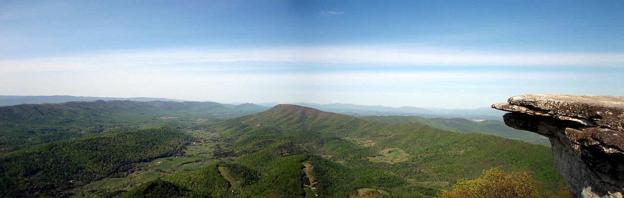
The Mendota Fire Tower sits at the summit, though the bottom section of steps has been removed for safety. You can still climb partway up for views, but honestly, the ground-level perspective is spectacular enough. You’re standing dead center on Clinch Mountain’s ridge, with the mountain stretching out like a spine toward the southwest and northeast. On clear days, you can spot Big Knob to the southwest and Big A Mountain in the distance. The locals weren’t kidding when they named “the Butt” — that large mountain to the right really does look like what you think it does.
This trail is rated hard for good reason, despite its short length. The grade is brutal and unforgiving — I’ve seen seasoned hikers huffing and stopping multiple times on the way up. Your calves and quads will be screaming, and if you’re not in decent shape, you’ll be taking breaks whether you want to or not. The descent is almost harder on your knees, so bring trekking poles if you have them.
Early morning or late afternoon works best to avoid the heat — there’s minimal shade on this exposed climb. Spring brings blooming mountain laurel around late May, which softens the brutal grade with some beauty. Fall is prime time for hawk migration, and you’ll likely see dozens circling the thermals around the ridge. Avoid summer midday unless you enjoy suffering.
The trailhead is right off Route 58 near Mendota — look for a small pullout with space for maybe three cars. No fees, no facilities, and cell service is spotty at best. Watch for poison ivy along the trail edges, especially in warmer months. Bring water even for this short hike — you’ll need it after that climb. The nearest real town is Gate City, about 15 minutes away for gas and snacks.
LOWA Renegade EVO GTX MidGORE-TEX, 3 widths, resolableCheck price on Amazon →Hydro Flask Wide Mouth 32ozinsulated, durableCheck price on Amazon →Osprey Talon 22ventilated back, pole carryCheck price on Amazon →Adventure Medical Kits Ultralight Watertight .7day-hike specific, waterproofCheck price on Amazon →Black Diamond Spot 400-Rrechargeable, comfortableCheck price on Amazon → Patagonia Torrentshell 3L Jacketdurable, trail + everydayCheck price on Amazon →
 Darn Tough Hiker Micro Crew Midweightlifetime warrantyCheck price on Amazon →
 Black Diamond Pursuit Trekking Polescork grip, lightweightCheck price on Amazon →
 Sawyer Squeeze Water Filterultralight, standard threadsCheck price on Amazon →