LOWA Renegade EVO GTX MidGORE-TEX, 3 widths, resolableCheck price on Amazon →
 Hydro Flask Wide Mouth 32ozinsulated, durableCheck price on Amazon →
 Osprey Talon 22ventilated back, pole carryCheck price on Amazon →
 Adventure Medical Kits Ultralight Watertight .7day-hike specific, waterproofCheck price on Amazon →
 Black Diamond Spot 400-Rrechargeable, comfortableCheck price on Amazon →
What to Expect on the Trail
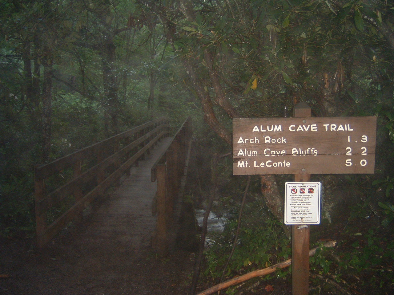
The Alum Cave Trail is the most popular approach to Mount LeConte and one of the most hiked trails in Great Smoky Mountains National Park. The trail from the Alum Cave trailhead on Newfound Gap Road climbs 1,100 feet in 2.3 miles to the bluffs through a progression of geological and botanical features that make every section distinct.
The first mile follows Alum Cave Creek through a dense hemlock and rhododendron tunnel. The canopy is so thick that the trail stays cool and shaded even in midsummer. The creek provides constant sound, and the rhododendron blooms in June create a floral corridor that draws visitors specifically for the bloom. At 1.3 miles the trail passes through Arch Rock — a natural rock tunnel where stone steps have been carved into the passage. The arch is narrow and dramatic, a geological feature that would be a destination hike on its own in a less feature-rich park.
Past Arch Rock the grade steepens. The trail climbs through a transition zone where the lower forest gives way to higher-elevation species. At Inspiration Point, about 1.8 miles in, a cleared viewpoint opens the first big panorama of the Smokies ridgeline. The view stretches across the valleys and peaks of the central park, providing a preview of the scale that the LeConte summit delivers in full.
The bluffs themselves are a massive overhanging rock formation — not a cave, but a concavity in the cliff face large enough to shelter dozens of hikers from rain. Mineral deposits streak the rock walls in bands of white, gray, and rust. The overhang creates an acoustically resonant space where the sounds of the forest echo off the rock. During the Civil War era, the mineral deposits (alum salts) were mined from the bluff face, which is how the formation got its name.
How Hard Is This Trail, Really?
Moderate to challenging. The 1,100 feet of gain in 2.3 miles produces a sustained grade that steepens progressively. The first mile through the creek tunnel is manageable. The climb past Arch Rock to Inspiration Point is steeper. The final push to the bluffs is the hardest section — rocky, rooty, and relentless. Budget 2.5 to 3.5 hours for the round trip to the bluffs.
The trail surface is packed dirt with rocks and roots that increase in density as you climb. The upper sections can be slippery when wet. Trekking poles help significantly on the descent, when tired legs and loose footing combine to create the conditions where ankle injuries happen. Hiking boots are strongly recommended; sneakers compromise your stability on the rock sections.
For hikers with ambitions beyond the bluffs, the trail continues another 2.7 miles to the summit of Mount LeConte at 6,593 feet. The full round trip is 10 miles with 2,560 feet of total gain — a demanding full-day hike. LeConte Lodge near the summit is the highest guest lodge in the eastern United States, reachable only by foot. Overnight reservations book up a year in advance.
Alum Cave Trail is a natural companion to Rainbow Falls, which approaches LeConte from the other side. Hikers who want the full LeConte experience sometimes ascend via Alum Cave and descend via Rainbow Falls (or vice versa) with a car shuttle between trailheads.
Best Time to Go
Rhododendron bloom (mid-June through early July) is the premier event for the lower trail section. The dense rhododendron tunnel along Alum Cave Creek becomes a floral corridor that draws visitors from across the region. Fall foliage (mid-to-late October) is excellent throughout, with the transition between elevation zones creating layers of color visible from Inspiration Point.
Spring wildflowers (April through May) are prolific in the lower forest. Winter offers frozen mineral seeps on the bluff face and dramatically fewer crowds, though the upper trail can be icy and treacherous. Microspikes are essential from November through March.
The parking situation at Alum Cave is the tightest in the park. The trailhead lot fills by 8 AM on weekends from May through October. The National Park Service requires parking tag reservations (via recreation.gov) during peak season — check current requirements before your visit. Without a reservation, you will be turned away when the lot is full.
Before You Go
The Alum Cave trailhead is on Newfound Gap Road (US-441), about 8.6 miles from the Sugarlands Visitor Center near Gatlinburg. Great Smoky Mountains National Park is free — no entrance fee. Parking tag reservations are required during peak season. Check recreation.gov for current reservation windows and availability.
No restrooms at the trailhead. The nearest facilities are at the Sugarlands Visitor Center. No water on the trail — carry at least 1 liter per person for the bluffs hike, 2+ liters for the LeConte extension. Cell service is unreliable. The trail is well-maintained and well-marked.
Dogs are not allowed on this trail or most trails in the Smokies. The drive from Gatlinburg is about 15 minutes. From Knoxville, about 50 minutes. From Asheville, about 1 hour via Newfound Gap Road (which crosses the park and is one of the most scenic drives in the eastern US).
Word from the Trail
Alum Cave Trail packs more geological variety into 2.3 miles than most trails manage in ten. Creek tunnel, rock arch, mountain panorama, mineral bluff — each section is distinct enough to feel like a different trail. The bluffs themselves are worth every step of the climb. Standing under that overhang, looking out at the Smokies through a frame of mineral-streaked rock, you understand why this is the most popular trail approach in the park. The LeConte summit above is for ambitious hikers. The bluffs are for everyone who can handle a steep 2.3-mile climb. Both groups get exactly what they came for.
Frequently Asked Questions
LOWA Renegade EVO GTX MidGORE-TEX, 3 widths, resolableCheck price on Amazon →Hydro Flask Wide Mouth 32ozinsulated, durableCheck price on Amazon →Osprey Talon 22ventilated back, pole carryCheck price on Amazon →Adventure Medical Kits Ultralight Watertight .7day-hike specific, waterproofCheck price on Amazon →Black Diamond Spot 400-Rrechargeable, comfortableCheck price on Amazon → Patagonia Torrentshell 3L Jacketdurable, trail + everydayCheck price on Amazon →
 Darn Tough Hiker Micro Crew Midweightlifetime warrantyCheck price on Amazon →
 Black Diamond Pursuit Trekking Polescork grip, lightweightCheck price on Amazon →
 Sawyer Squeeze Water Filterultralight, standard threadsCheck price on Amazon →