 LOWA Renegade EVO GTX MidGORE-TEX, 3 widths, resolableCheck price on Amazon →
 Hydro Flask Wide Mouth 32ozinsulated, durableCheck price on Amazon →
 Osprey Talon 22ventilated back, pole carryCheck price on Amazon →
 Adventure Medical Kits Ultralight Watertight .7day-hike specific, waterproofCheck price on Amazon →
 Black Diamond Spot 400-Rrechargeable, comfortableCheck price on Amazon →
Alum Cave Trail to Mount LeConte at a glance: An 11.2-mile out-and-back in the Great Smoky Mountains near Gatlinburg, climbing roughly 2,800 feet past Arch Rock and the Alum Cave Bluffs to the summit of Mount LeConte. Rated challenging, and the second half earns it — narrow ledges with cable handrails, a long steady grade, and ice that lingers into spring. Reserve a parking tag, arrive by 8am for the small roadside lot, and treat the Bluffs at 2.3 miles as a legitimate turnaround if the day is short.
Alum Cave is the most popular way up Mount LeConte, and for good reason: it packs the most scenery into the fewest miles of any route to the summit. The trail leaves Newfound Gap Road and climbs through old-growth forest to a run of landmarks (a creek-side start, the tunnel of Arch Rock, the open sweep of Inspiration Point, and the dry overhang of the Alum Cave Bluffs) before the real climbing begins toward the top of one of the highest peaks in the Smokies. Hikers rate it among the best trails in the park, and the consensus is that it delivers well beyond its 11-mile length.
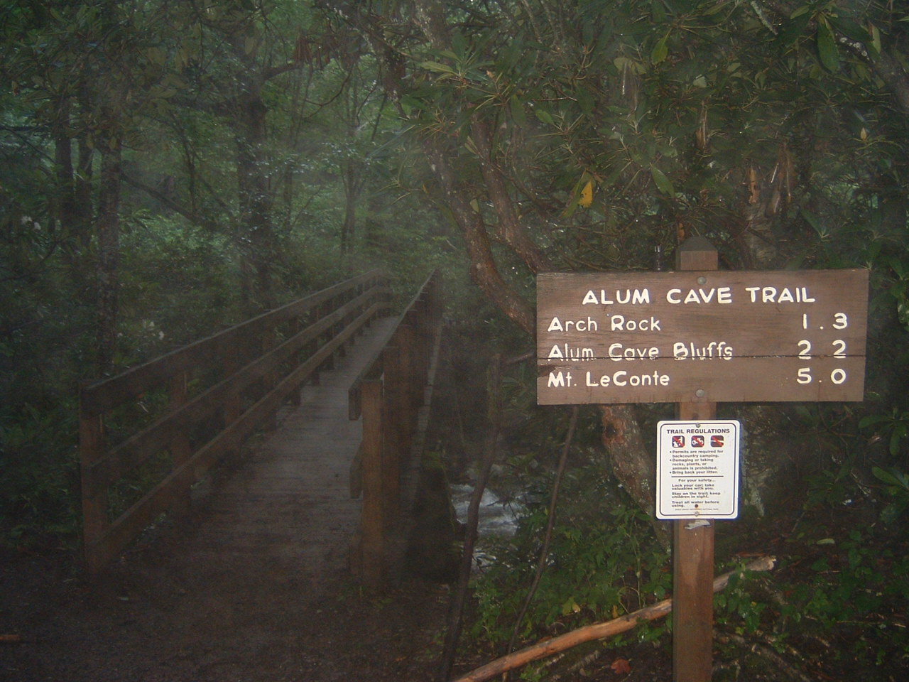
The trail starts gently, following Alum Cave Creek and crossing it on log bridges through a dense, mossy hardwood forest. About 1.4 miles in you reach Arch Rock, where the path climbs a set of stone steps straight through a natural arch in the rock. It is a genuine highlight and the first sign the trail has more character than its mileage suggests. From there the grade steepens toward Inspiration Point, a rocky opening with the first big views out over the valley and across to Little Duck Hawk Ridge.
At roughly 2.3 miles you arrive at the Alum Cave Bluffs, a massive dry overhang that most day hikers treat as either a destination in itself or a natural rest stop. This is the point where many hikers turn around for a shorter, still-rewarding 4.6-mile round trip. Beyond the Bluffs the trail changes character entirely: it narrows onto exposed ledges cut into the mountainside, several protected by steel cable handrails bolted to the rock. This upper section is the part hikers remember, and it is also where footing matters most.
The final push gains the summit ridge of Mount LeConte at about 6,590 feet, where the historic LeConte Lodge sits among the spruce and fir, a rustic backcountry lodge reachable only on foot. The true high point and the nearby Cliff Tops and Myrtle Point overlooks are short walks from the lodge and reward the effort with the long-range views that draw people up in the first place.
Officially challenging, and honest about it. The difficulty is not any single brutal climb but the steady accumulation of roughly 2,800 feet of gain spread over 5.6 miles up, with the steepest and most exposed terrain saved for the second half. Hikers consistently describe the trail as strenuous but manageable with a reasonable base of fitness, and most complete the round trip in about six to eight hours depending on time spent at the top.
The feature that most often catches people off guard is the ledge section above Alum Cave Bluffs. In dry summer conditions the cables are reassuring and the footing is solid. In winter and early spring, those same ledges hold ice long after the trailhead looks clear, and this is the terrain most likely to cause a fall. Hikers who tackle it in the cold months treat traction devices as essential, and several describe turning back at the Bluffs when the upper trail was glazed. Mud is the other recurring theme: the lower forest stays damp, and well-worn sections churn up quickly after rain.
The park lists March through November as the prime window, and hikers largely agree. Late spring brings wildflowers through the lower forest and the most reliable footing on the upper ledges. Summer is the busiest stretch and the most forgiving underfoot, though afternoon thunderstorms build fast at elevation and the parking situation is at its worst. Fall delivers color and crisp long-range views but draws heavy crowds on weekends.
Winter is a different trail. The summit holds snow and the cable-protected ledges ice over, turning a challenging day hike into one that demands microspikes, layers, and a willingness to turn around. Hikers who go in the cold season describe a quieter, starker version of the route, worth it for the solitude, but only with the right traction and a hard turnaround discipline. Whatever the season, an early start is the single most repeated piece of advice, both for parking and for beating afternoon weather off the exposed upper trail.
Parking is the first real hurdle. The Alum Cave trailhead has only a modest roadside lot on Newfound Gap Road, and it fills early on any decent-weather day, so hikers repeatedly recommend arriving by 8am, especially on weekends, or planning to circle for a spot. The Great Smoky Mountains now requires a paid parking tag for any stop longer than 15 minutes, so buy one in advance and have it displayed; this comes up often enough in recent trip reports to plan around.
Dogs are not allowed on this trail, a park-wide rule on nearly all Smokies footpaths that surprises first-time visitors. There is no reliable water on the climb, so carry more than you think you’ll need, particularly in summer. If you’re aiming to stay at LeConte Lodge rather than day-hike, be aware the lodge books up roughly a year in advance and is not a walk-up option. Cell service is spotty to nonexistent for most of the route.
The trailhead sits about 20 minutes from Gatlinburg along Newfound Gap Road, which makes it an easy add-on to a Smokies trip but a long haul as a standalone day trip from outside the region. Pairing it with a lower, shorter hike or a scenic drive over Newfound Gap is a common way to round out the day.
Alum Cave earns close to universal praise from the people who hike it — the large majority rate it a five-star outing and single out the variety as the reason, since few trails string together an arch, a cliff-side cave, cable-protected ledges, and a genuine summit in one climb. The recurring caution alongside that praise is preparation: hikers who came with traction in the cold months, water in the heat, and an early enough start to secure parking tended to have the effortless version of the day.
That is the fair summary. Alum Cave rewards the effort more generously than its mileage promises, and the difficulty is real without being extreme. Sort out parking, watch the upper ledges for ice, and give yourself the full day — do that, and it stands up as one of the finest hikes in the Great Smoky Mountains.
LOWA Renegade EVO GTX MidGORE-TEX, 3 widths, resolableCheck price on Amazon →Hydro Flask Wide Mouth 32ozinsulated, durableCheck price on Amazon →Osprey Talon 22ventilated back, pole carryCheck price on Amazon →Adventure Medical Kits Ultralight Watertight .7day-hike specific, waterproofCheck price on Amazon →Black Diamond Spot 400-Rrechargeable, comfortableCheck price on Amazon → Patagonia Torrentshell 3L Jacketdurable, trail + everydayCheck price on Amazon →
 Darn Tough Hiker Micro Crew Midweightlifetime warrantyCheck price on Amazon →
 Black Diamond Pursuit Trekking Polescork grip, lightweightCheck price on Amazon →
 Sawyer Squeeze Water Filterultralight, standard threadsCheck price on Amazon →

