LOWA Renegade EVO GTX MidGORE-TEX, 3 widths, resolableCheck price on Amazon →
 Hydro Flask Wide Mouth 32ozinsulated, durableCheck price on Amazon →
 Osprey Talon 22ventilated back, pole carryCheck price on Amazon →
 Adventure Medical Kits Ultralight Watertight .7day-hike specific, waterproofCheck price on Amazon →
 Black Diamond Spot 400-Rrechargeable, comfortableCheck price on Amazon →
What to Expect
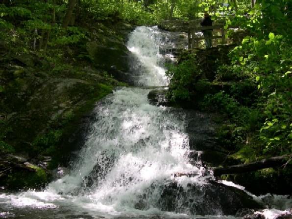
Apple Orchard Falls is a 200-foot waterfall in Jefferson National Forest, accessed from a trailhead near Blue Ridge Parkway milepost 78.4. It’s a National Recreation Trail and one of the most impressive waterfalls on the entire Parkway — the falls cascade down a steep rock face in a narrow gorge, and the approach from the lower trailhead puts you right at the base with the full height above you. Worth the drive.
The standard route from the lower Sunset Field trailhead follows the creek upstream through dense forest, gaining 1,000 feet over 1.2 miles to the falls. The trail is rocky and wet in sections — the creek crossing just before the falls is usually a rock-hop but can run high after significant rain. The forest along the creek is old and the canopy is thick, which means the lower trail stays cool on warm days. You’ll hear the falls before you see them.
The upper trail connects to the Parkway near the Apple Orchard Mountain radar station if you want to extend the trip, but most people do the out-and-back from the lower lot. The 2.4-mile round trip is short enough that it works as a standalone stop or combined with Sharp Top 6 miles north on the Parkway.
Difficulty
Strenuous for the mileage. The 1,000-foot gain in 1.2 miles is a sustained push with rocky, uneven footing throughout. The wet sections of trail can be genuinely slippery — traction matters here more than on a typical dirt trail. The creek crossing at the base of the falls is usually manageable but be prepared for wet feet in high water. Budget 1.5 to 2.5 hours round trip.
Best Time to Go
Spring is the best time — peak flow after snowmelt and spring rains turns the falls into something impressive. Late March through May. By late summer the falls can reduce significantly, sometimes to a trickle during drought years. Fall is still worthwhile for the color along the creek corridor. The Parkway access road is subject to winter closures, so check before going November through March.
Before You Go
The lower Sunset Field trailhead is on VA-614 off US-501 north of Glasgow — the approach from the Parkway involves a short unpaved road section. From the Parkway itself, the upper trailhead at milepost 78.4 is more direct. About 75 miles from Charlottesville. No fee. There are no facilities at either trailhead. Bring water — the creek water at the falls requires treatment. The nearest services are in Glasgow or Buena Vista, both about 15 miles south on US-501. Cell service is unreliable throughout.
Frequently Asked Questions
LOWA Renegade EVO GTX MidGORE-TEX, 3 widths, resolableCheck price on Amazon →Hydro Flask Wide Mouth 32ozinsulated, durableCheck price on Amazon →Osprey Talon 22ventilated back, pole carryCheck price on Amazon →Adventure Medical Kits Ultralight Watertight .7day-hike specific, waterproofCheck price on Amazon →Black Diamond Spot 400-Rrechargeable, comfortableCheck price on Amazon → Patagonia Torrentshell 3L Jacketdurable, trail + everydayCheck price on Amazon →
 Darn Tough Hiker Micro Crew Midweightlifetime warrantyCheck price on Amazon →
 Black Diamond Pursuit Trekking Polescork grip, lightweightCheck price on Amazon →
 Sawyer Squeeze Water Filterultralight, standard threadsCheck price on Amazon →