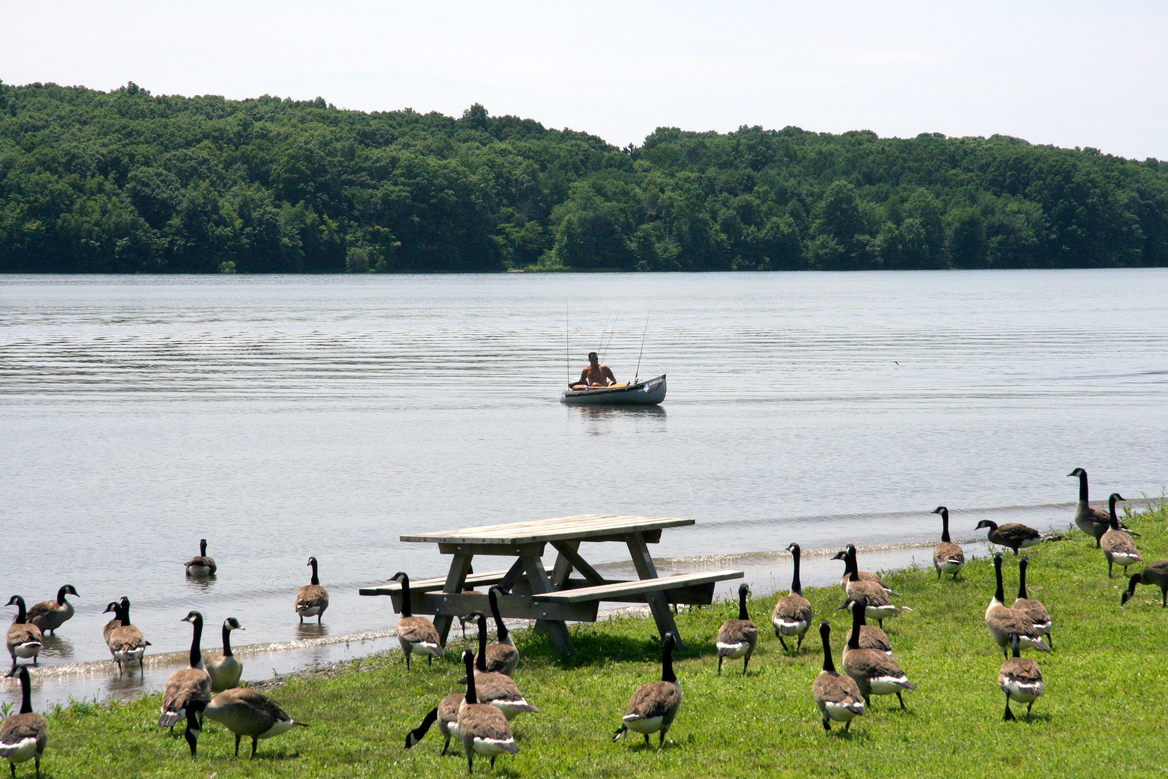
Lake Scranton
Photo: WHAMMBO
(CC via Wikimedia)
 LOWA Renegade EVO GTX MidGORE-TEX, 3 widths, resolableCheck price on Amazon →
 Hydro Flask Wide Mouth 32ozinsulated, durableCheck price on Amazon →
 Osprey Talon 22ventilated back, pole carryCheck price on Amazon →
 Adventure Medical Kits Ultralight Watertight .7day-hike specific, waterproofCheck price on Amazon →
 Black Diamond Spot 400-Rrechargeable, comfortableCheck price on Amazon →
Lake Scranton at a glance: A 4.6-mile gravel loop around a public drinking-water reservoir in Lackawanna County. Easy, well-maintained, and the closest reliable trail to downtown Scranton. Best treated as a daily walk or a 90-minute wildlife loop, not a destination hike.
Lake Scranton is the kind of trail nobody travels for and everyone who lives nearby ends up doing weekly. A 4.6-mile loop around a drinking-water reservoir, mostly flat, mostly shaded, with bald eagle sightings in winter and herons through summer. It is the daily walk that holds up to repeat visits.
The trail follows a maintenance road around the perimeter of the lake, primarily on a packed gravel and dirt surface. The footing is forgiving and the grade is gentle: about 338 feet of total elevation change spread over the full 4.6 miles, which means there is no real climb anywhere. The route stays close to the water for most of its length, with occasional inland detours to bypass the reservoir’s narrow inlets and outflow structures.
Mixed hardwood forest covers most of the route, with oak, maple, and hemlock dominating the canopy and open lake views breaking through the trees every quarter mile or so. The eastern shore tends to have the most consistent waterfront access and the best winter morning light; the western shore is more wooded and the better choice on hot summer afternoons. Either direction works for a complete loop.
Wildlife is the underrated reason to come back. Waterfowl are constant: mallards, mergansers, Canada geese in significant numbers, and great blue herons stalking the inlets. White-tailed deer browse the woods along the southern stretch, especially at dawn and dusk. Bald eagle sightings in winter, when the deciduous canopy is thin and the lake stays partially open, are common enough that regulars carry binoculars.
The reservoir has supplied drinking water to Scranton since the late 1800s, when the city’s industrial growth outpaced its older water sources. The dam at the southern end of the lake dates to that era and remains in active use; the trail crosses the structure on a paved walkway that gives the only real overlook of the entire reservoir surface from above. The water authority maintains the trail as part of standard reservoir-corridor patrol, which is why the surface is consistently clean and the corridor is consistently posted.
Easy in every measure. The 4.6-mile distance is the limiting factor for casual walkers, not the terrain. The 338 feet of elevation change is distributed in gentle rolling sections, with no segment requiring sustained effort. Trail surface is consistently maintained gravel and packed dirt, with a few short paved stretches near the dam.
Most fit walkers complete the loop in 90 minutes at a steady pace; an unhurried walk with photo stops takes closer to two and a half hours. The trail handles strollers in dry conditions, but the gravel surface is harder work for narrow wheels, and a few short steeper grades near the dam crossing will challenge anyone pushing a stroller alone. Wet weather softens the surface in low spots, particularly along the southern shore.
Year-round, which is a rare claim for any Northeast trail. Spring brings waterfowl activity, with mergansers and migrating songbirds through April and early May. Summer turns the canopy thick and the trail comfortably cool, even on warm days. Mid-October delivers the standout fall color reflected on the lake, when the maples and birches along the shore turn against the dark hemlock backdrop.
Winter is the quiet favorite among regulars. Once the leaves drop, the lake views open up dramatically along the entire eastern shore. Bald eagles winter over on the lake, and a still cold morning can produce a string of waterfowl, deer, and raptor sightings within a single loop. The trail surface holds up well in cold conditions; microspikes help on icy mornings but are rarely strictly necessary.
The trail is on Pennsylvania American Water property, and the reservoir is an active public drinking water source. The standard rules apply: no swimming, no wading, no boats, no fishing, and no direct contact with the water. Dogs are welcome on leash but should be kept well away from the shoreline. Pack out everything; the water authority polices the trail seriously.
Parking is at the eastern access gate off Lake Scranton Road. The lot is small but rarely full, with a few additional shoulder spots along the road. Cell service is workable around most of the loop. There are no restrooms or water on the trail; downtown Scranton is a ten-minute drive for either. The trail closes at sunset, and the gates are locked overnight, so plan a finish well before dusk in winter. Carry pepper spray for bears in late spring and summer; black bears are present in the Lackawanna County woods, and while encounters on the trail itself are uncommon, the corridor backs up against undeveloped forest in several stretches.
Lake Scranton is the trail Lackawanna County residents recommend when out-of-town friends ask about a quick hike near downtown. Hikers consistently describe it as the most reliable walking option in the area: never closed for long, never crowded, never weather-dependent the way the higher-elevation trails in the Poconos can be. The standing-water restrictions keep the lake quiet, which is part of why the wildlife stays around.
The route is also the rare suburban-adjacent trail with genuine variety from season to season. Early-morning summer walks, late-October leaf-watching loops, and sub-freezing winter eagle-spotting circuits all happen on the same gravel loop, and regulars describe walking it across four seasons as four different hikes. For visitors passing through Scranton with a free morning, Lake Scranton is the answer to the “what’s the easy local walk worth doing” question. Not the destination hike, but a real, useful, repeatable loop that holds up to scrutiny on its own terms. Pair it with a coffee stop in downtown Scranton or a visit to the Steamtown National Historic Site afterward to make a half-day of it.
LOWA Renegade EVO GTX MidGORE-TEX, 3 widths, resolableCheck price on Amazon →Hydro Flask Wide Mouth 32ozinsulated, durableCheck price on Amazon →Osprey Talon 22ventilated back, pole carryCheck price on Amazon →Adventure Medical Kits Ultralight Watertight .7day-hike specific, waterproofCheck price on Amazon →Black Diamond Spot 400-Rrechargeable, comfortableCheck price on Amazon → Patagonia Torrentshell 3L Jacketdurable, trail + everydayCheck price on Amazon →
 Darn Tough Hiker Micro Crew Midweightlifetime warrantyCheck price on Amazon →
 Black Diamond Pursuit Trekking Polescork grip, lightweightCheck price on Amazon →
 Sawyer Squeeze Water Filterultralight, standard threadsCheck price on Amazon →
_(9290295228).jpg?width=800)