LOWA Renegade EVO GTX MidGORE-TEX, 3 widths, resolableCheck price on Amazon →
 Hydro Flask Wide Mouth 32ozinsulated, durableCheck price on Amazon →
 Osprey Talon 22ventilated back, pole carryCheck price on Amazon →
 Adventure Medical Kits Ultralight Watertight .7day-hike specific, waterproofCheck price on Amazon →
 Black Diamond Spot 400-Rrechargeable, comfortableCheck price on Amazon →
High Rocks at a glance: A 3.6-mile loop above and below a 200-foot sheer cliff over Tohickon Creek, splitting its time between an airy rim with the best view in Bucks County and a hemlock gorge with creek access below. The cliff edge is unfenced and the descent trails carry loose rock, so this is a watch-your-step hike rather than a stroll. Rock climbers work the bolted walls, the creek invites hot-day wading, and the big views arrive minutes from the parking lot.
High Rocks is where Bucks County stops being gentle. At the boundary of Ralph Stover State Park and Tohickon Valley County Park, Tohickon Creek has carved a horseshoe bend under a 200-foot wall of red shale and siltstone, and the loop trail works both levels of the drama: the rim, with its clean drop and long forested views, and the gorge floor, where the creek runs fast under old hemlocks. Nearly 4,850 hikers rate the loop 4.6, and the ones who sound surprised are usually the ones who thought they knew Bucks County.
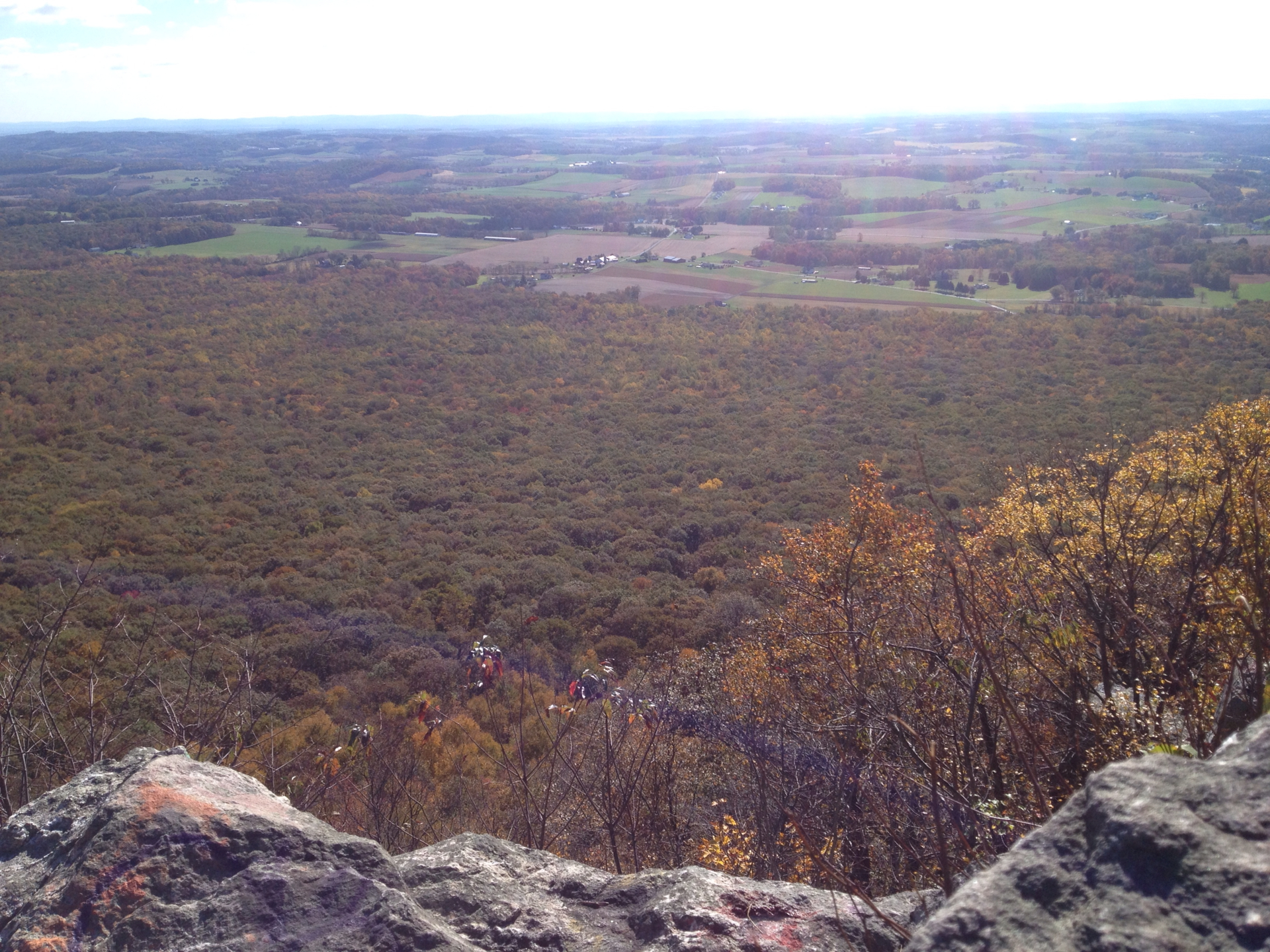
The loop runs about 3.6 miles, and it front-loads the spectacle: the main overlooks sit minutes from the trailhead, a series of unfenced rock platforms staring down at the creek’s bend far below. The view is the best in the county and the exposure is real — the drop is immediate, the shale flakes underfoot, and wet rock turns the rim from thrilling to genuinely risky. Keep kids in hand and dogs on short leashes here, then enjoy it, because the rim walking between viewpoints is easy and shaded.
From the rim, the route descends into the gorge on the orange-blazed lower trail, and this is where the loop earns its rating. The descent carries loose rock and heavy roots, with sections traversing above the river steeply enough that several reviewers hesitated with dogs after rain. The reward at the bottom is a different world: mature hemlock forest, cool air, and Tohickon Creek sliding over rock slabs that make natural rest stops. On hot days hikers wade and cool off in the pools, and in spring the gorge is loud with high water.
The cliffs themselves belong to the climbing community as much as the hikers. The walls are an established sport-climbing area, and on any decent weekend you will watch roped climbers working routes below the overlooks, belayers looking small at the base. The yellow-blazed ridge trail and connector paths offer shortcuts if the full loop is more than the day allows, and the trail network crosses between the state and county parks without any visible seam.
Moderate, concentrated in two places: the descent into the gorge and the climb back out, roughly 500 feet of elevation change round trip. The footing does the rest — loose rock and root systems appear in nearly every review, and steep inclines with rubble underfoot demand real shoes and, for many hikers, poles. Two hours covers the loop comfortably with stops at the rim and the creek.
The difficulty is honest but manageable for most. Surefooted kids handle it with supervision; the unfenced rim, not the trail grade, is the actual hazard to manage. After rain, both hazards sharpen — greasy shale on the overlooks, slick roots on the descent — and the smart move is running the loop in dry conditions the first time. Long pants earn their keep too: poison ivy edges the sunnier stretches all summer.
Fall is exceptional. The gorge holds color on three sides through mid-October, the hemlocks stay green against the hardwoods, and the cooler rock brings out the most climbers to watch. Spring is the water season, with Tohickon Creek running full and loud through the gorge — and twice a year, scheduled dam releases upstream turn the creek into a whitewater event that draws kayakers and spectators to the rim.
Summer works better than its humidity suggests, since the gorge floor runs cool under the hemlocks and the creek pools take the edge off; the price is bugs in the bottom and poison ivy along the margins. Winter belongs to the careful: the views from the leafless rim are the year’s clearest, but ice on shale is unforgiving, so save it for dry cold snaps. Weekday mornings are quiet in any season, and the loop rarely feels crowded even when the lots are moving.
The most common start is the Tohickon Valley County Park lot on Cafferty Road near Point Pleasant, with additional parking at Ralph Stover State Park proper; lots are free but modest, and nice-weekend afternoons can fill them, so mornings are the reliable play. Restrooms operate seasonally at the county park side. The parks are open dawn to dusk, with no fee for hiking.
Dogs are allowed on leash and manage the loop well in dry conditions, with two cautions the reviews repeat: keep them well back from the unfenced rim, and expect the orange lower trail’s steep, loose sections to be awkward for less agile dogs. Cell service drops in the gorge, so download the map — the blaze system is clear, but the junction web between the two parks rewards a reference.
The area makes an easy full day. New Hope and its restaurants sit eight miles south along the Delaware, the canal towpath offers a flat cool-down walk, and Ringing Rocks County Park, with its bell-toned boulder field, is a short drive north. But the rim view is the reason you came, and it is worth planning the day around.
A 4.6 from nearly 4,850 hikers puts High Rocks at the top of Bucks County’s trail rankings, and the reviews split their praise between the two halves — the cliff-top views that photograph like the Poconos, and the hemlock gorge that hikes like them. Watching the climbers is the recurring bonus, and the creek wading is the recurring summer save.
The cautions repeat just as reliably: loose rock everywhere, watch your step, real shoes not sneakers, mind the edge, and think twice about the lower trail with a dog right after rain. None of it discourages; it reads like regulars protecting a place they intend to keep visiting. For drama per mile within an hour of Philadelphia, nothing else in the county comes close.
LOWA Renegade EVO GTX MidGORE-TEX, 3 widths, resolableCheck price on Amazon →Hydro Flask Wide Mouth 32ozinsulated, durableCheck price on Amazon →Osprey Talon 22ventilated back, pole carryCheck price on Amazon →Adventure Medical Kits Ultralight Watertight .7day-hike specific, waterproofCheck price on Amazon →Black Diamond Spot 400-Rrechargeable, comfortableCheck price on Amazon → Patagonia Torrentshell 3L Jacketdurable, trail + everydayCheck price on Amazon →
 Darn Tough Hiker Micro Crew Midweightlifetime warrantyCheck price on Amazon →
 Black Diamond Pursuit Trekking Polescork grip, lightweightCheck price on Amazon →
 Sawyer Squeeze Water Filterultralight, standard threadsCheck price on Amazon →