_(9290295228).jpg?width=800)
Bear Creek Preserve — NEPA Hiking Trails
Photo: Nicholas A. Tonelli
(CC via Wikimedia)
 LOWA Renegade EVO GTX MidGORE-TEX, 3 widths, resolableCheck price on Amazon →
 Hydro Flask Wide Mouth 32ozinsulated, durableCheck price on Amazon →
 Osprey Talon 22ventilated back, pole carryCheck price on Amazon →
 Adventure Medical Kits Ultralight Watertight .7day-hike specific, waterproofCheck price on Amazon →
 Black Diamond Spot 400-Rrechargeable, comfortableCheck price on Amazon →
Bear Creek Preserve at a glance: A 5.5-mile creek-side loop through a big, quiet Natural Lands preserve fifteen minutes from Wilkes-Barre, with small waterfalls, multiple stream crossings and narrow singletrack above the water. Go counterclockwise so the climbing comes gently and the creek section arrives as the reward. Footing is the whole challenge here: rocks, roots, log crossings and side-slope trail that demands attention. The name is not decorative — hikers do meet black bears.
Bear Creek Preserve is what happens when a land trust protects more than 3,000 acres of northeastern Pennsylvania forest and then keeps the improvements minimal. The Creek Trail Loop, stitched together from the preserve’s red connector and gray creek trails, runs about 5.5 miles through hemlock ravines and hardwood benches above a lively stream, past small waterfalls that most parks would put on a brochure. Roughly 570 hikers rate it 4.6 stars, and the recurring theme is disbelief that something this quiet sits ten minutes off the interstate.
Counterclockwise is the direction the regulars insist on, and they are right. Taken that way, the loop spends its first half working gradually through mixed forest on wide, well-marked trail, saving the creek corridor for the second half when you have earned it. Hiked clockwise, the same route ends with a grinding climb away from the water that more than one reviewer describes as an unwelcome surprise.
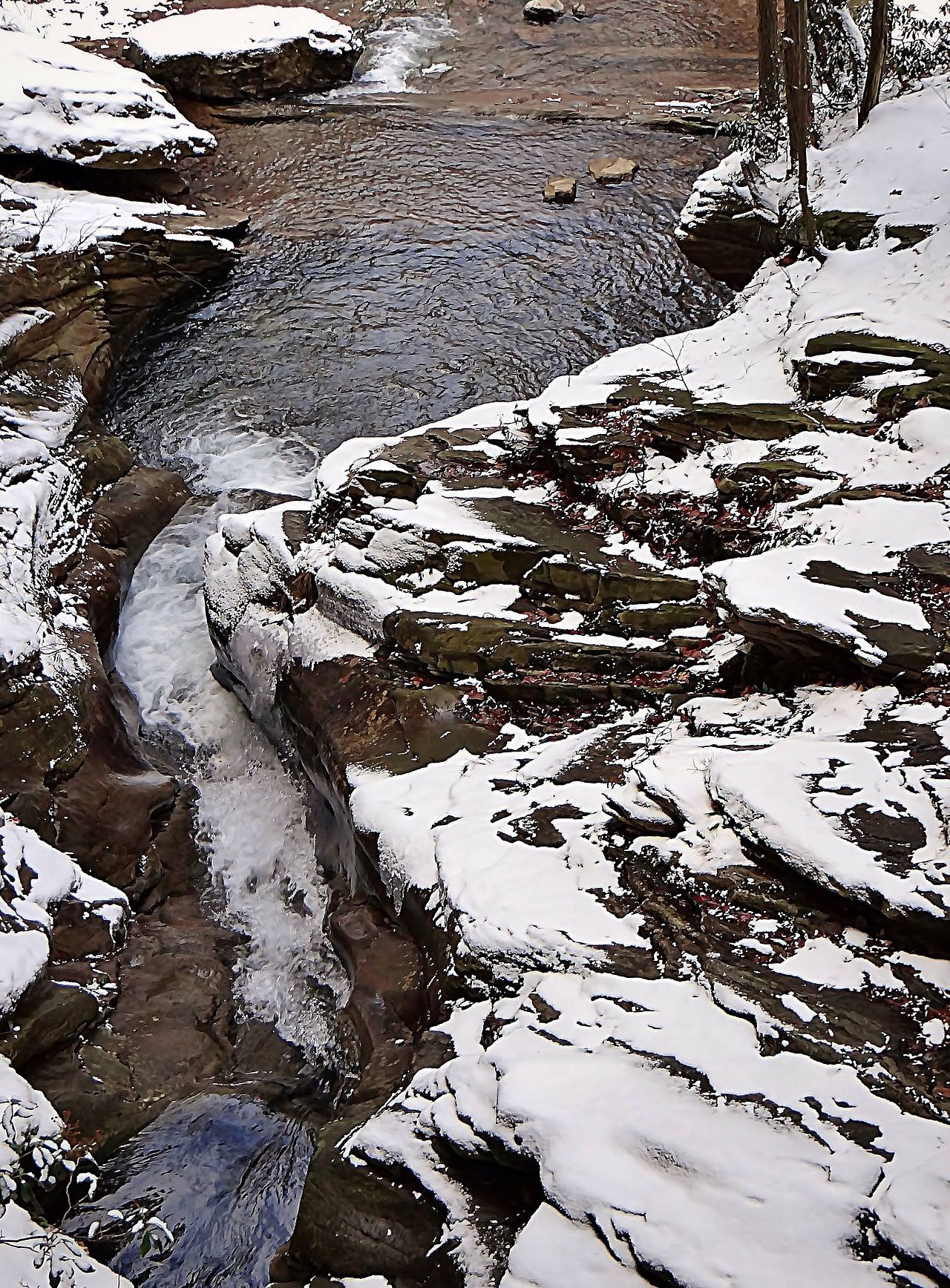
The creek stretch is the reason to come. The gray trail narrows to singletrack that hugs the bank, passing pools, small cascades and rock slabs, with the water loud enough to cover conversation in spring. Crossings come regularly, some on wooden bridges, some on logs or rock-hops that turn interesting after rain. Sections of the path run along a side-slope above the water with real consequences for a careless step, which keeps the loop engaging without ever becoming technical.
The preserve rewards attention as much as effort. Fern understory, old stone walls and the occasional glacial boulder break up the woods, waterfalls appear both along the creek and on feeder streams, and wildlife sightings run richer than the region’s busier parks — deer and grouse routinely, and black bears often enough that reviews mention them matter-of-factly. This is a preserve first and a recreation site second, and the traffic reflects it: even on good weekends the loop feels close to private.
Moderate, with the difficulty living entirely in the footing. Elevation change is modest and comes gradually in the counterclockwise direction, so the 5.5 miles pass in a bit over two hours for most hikers. What earns the rating is the sustained attention the trail demands: rocky stretches where ankles roll, roots slicked by shade, muddy patches that linger days after rain, and those narrow creek-side sections above the water. Several reviewers note it hikes harder than novices expect, and the multiple water crossings over logs are where walking sticks stop being optional. Budget extra time on a first visit; the constant footing decisions slow the pace more than the mileage math suggests.
Boots with ankle support beat trail runners here, and trekking poles pay off at the log crossings and rock-hops. After rain the calculus shifts: the crossings run higher, the mud spreads, and the side-slope singletrack becomes genuinely slick. Winter brings ice to the creek corridor and turns the loop into a spikes-required outing. In dry conditions, any reasonably fit hiker will find it a satisfying half-day rather than a hard one.
Late spring through fall is the window, and each end has its argument. May and June bring the creek at full voice, mountain laurel in the understory and the waterfalls at their best, with the price paid in gnats after wet spells — more than one review recommends bug spray by name. October is the other peak, when the hardwood canopy turns above the hemlocks and the low water makes every crossing trivial.
Summer works well since the ravine holds shade and the water invites dogs and feet at every crossing. Winter is beautiful and nearly empty, but the ice along the creek demands traction gear and experience, though the heated restrooms make cold-weather starts far more pleasant than the region’s average trailhead. Note the preserve’s own guidance that late fall involves hunting seasons: check the schedule before a November visit and wear blaze orange when it applies.
The preserve sits off Route 115 near Bear Creek Village, about fifteen minutes from Wilkes-Barre and half an hour from Scranton. Parking is free, and the main lot holds roughly a dozen cars — modest, but adequate for a place this uncrowded outside peak fall weekends. The lot has restrooms, and unusually for a trailhead in this region, they are heated and open in winter.
Dogs are welcome on leash and tend to love the loop for obvious reasons, with water access at crossing after crossing. Keep them close along the side-slope sections and be bear-aware: sightings here are routine enough that a leash is a safety item, not a formality. Cell service is intermittent in the ravines.
The junctions are well-signed and the color-coded system is easy to follow, but the network offers multiple loops — yellow and purple trails add waterfalls and mileage for return visits — so downloading the preserve map saves second-guessing. Bridge maintenance happens periodically; if a crossing is decked in scaffolding or closed, the rock-hop alternatives are usually manageable at normal water levels.
A 4.6 rating from about 570 hikers puts Bear Creek among the best-reviewed quiet trails in northeastern Pennsylvania, and the notes are consistent: the creek section and waterfalls earn the stars, the solitude seals them, and the counterclockwise advice appears in review after review. The complaints are few — rocky footing, post-rain mud, the occasional rough bridge — and read more like briefing notes than grievances.
The picture that emerges is a preserve that asks a little more attention than its stats suggest and returns more scenery than its fame suggests. Wear real boots, go counterclockwise, pack bug spray in June and blaze orange in November, and Bear Creek delivers the best kind of local hike: the one you stop telling people about so it stays this empty.
LOWA Renegade EVO GTX MidGORE-TEX, 3 widths, resolableCheck price on Amazon →Hydro Flask Wide Mouth 32ozinsulated, durableCheck price on Amazon →Osprey Talon 22ventilated back, pole carryCheck price on Amazon →Adventure Medical Kits Ultralight Watertight .7day-hike specific, waterproofCheck price on Amazon →Black Diamond Spot 400-Rrechargeable, comfortableCheck price on Amazon → Patagonia Torrentshell 3L Jacketdurable, trail + everydayCheck price on Amazon →
 Darn Tough Hiker Micro Crew Midweightlifetime warrantyCheck price on Amazon →
 Black Diamond Pursuit Trekking Polescork grip, lightweightCheck price on Amazon →
 Sawyer Squeeze Water Filterultralight, standard threadsCheck price on Amazon →