 LOWA Renegade EVO GTX MidGORE-TEX, 3 widths, resolableCheck price on Amazon →
 Hydro Flask Wide Mouth 32ozinsulated, durableCheck price on Amazon →
 Osprey Talon 22ventilated back, pole carryCheck price on Amazon →
 Adventure Medical Kits Ultralight Watertight .7day-hike specific, waterproofCheck price on Amazon →
 Black Diamond Spot 400-Rrechargeable, comfortableCheck price on Amazon →
Mount Mitchell Loop at a glance: A 6.1-mile loop that summits the highest peak east of the Mississippi at 6,684 feet, linking Mount Mitchell with neighboring Mount Craig along the Black Mountain crest. Rated challenging, and famously muddy, with steep, rope-assisted scrambles on the crest. Direction matters, so read up before choosing clockwise or counterclockwise, wear waterproof boots, and save it for the warmer months, since the summit is cold and snowy much of the year.
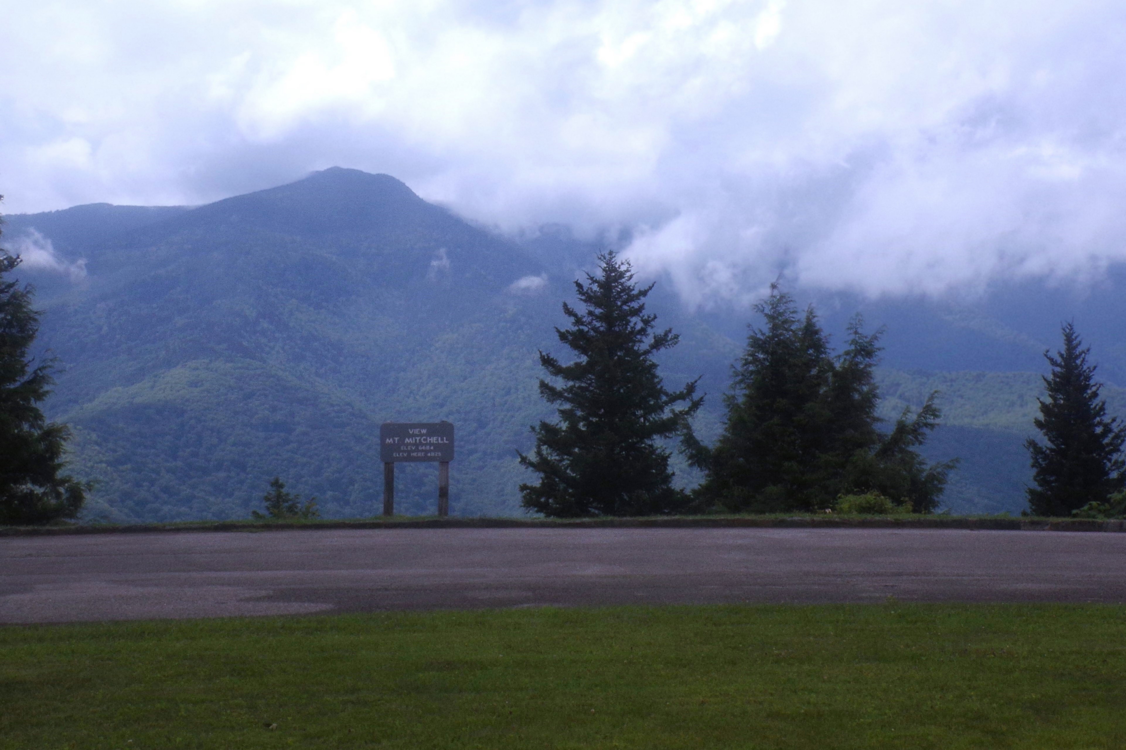
Mount Mitchell is the highest point in the eastern United States, and while you can drive to its summit, the loop that links it with Mount Craig along the Black Mountain crest turns the high point into a genuine mountain hike. The route earns strong reviews for its ridge views and its wild, spruce-fir summit environment, tempered by two consistent warnings: it is relentlessly muddy, and the direction you choose makes a real difference to how hard it feels.
The loop combines the summit area of Mount Mitchell with a traverse north along the crest to Mount Craig, the second-highest peak in the East, before circling back. The high ground runs through a dark, fragrant spruce-fir forest that feels far more like Canada than the Carolinas, a remnant boreal environment that survives only on these highest summits. The peak is named for Elisha Mitchell, the scientist who measured its height and later died in a fall while working to confirm it, and who is buried at the summit, a piece of history that adds weight to the high point. Openings along the crest deliver big views over the surrounding Black Mountains and beyond.
The trail is rugged. Hikers describe steep, rocky sections on the crest with fixed ropes to help on the sharpest pitches, along with roots, rocks, and long stretches of deep mud that define the experience. Part of the loop follows a horse trail on its lower leg, which is wider but often churned and muddy, adding to the messy footing that dominates trip reports.
The summit of Mount Mitchell itself has an observation platform, restrooms, and a nearby parking area reachable by road, so the actual high point can be busy with visitors who drove up. That contrast between the crowded, developed summit and the wild, muddy crest is part of the loop’s character, and reaching the top under your own power is the appeal for hikers.
Challenging is the right call, and the difficulty is a combination of steep rocky scrambles, high elevation, and pervasive mud. Hikers repeatedly single out the mud as the defining feature, deep and persistent enough to slow the whole loop and demand waterproof footwear. The rope-assisted pitches on the crest add a hands-on element that catches some hikers by surprise.
Direction is a genuine decision here. Reviews are split between clockwise and counterclockwise, with strong opinions on which way makes the steep, rope-assisted sections safer to climb rather than descend, so it is worth reading recent trip reports before you start. At high elevation the air is thinner and the weather colder than the valley, and most hikers take around three to four hours for the loop. The honest read is a tough, muddy, rewarding high-country hike rather than a casual summit walk.
The prime window is roughly April through October, and even then the summit is cool. Summer offers the most reliable footing and the mildest conditions on top, though afternoon clouds and storms build quickly at elevation and the mud rarely fully dries. Fall brings crisp air and clear long-range views, with the spruce-fir crest a striking contrast to the color lower down.
Winter turns the loop into a serious undertaking, with snow, ice, and bitter cold on the highest peak in the East, and it is best left to well-equipped, experienced hikers. Snow and ice can linger into spring on the crest, so early-season hikers should be prepared for lingering winter conditions up high. In any season, the summit is markedly colder and windier than the trailhead, so pack layers.
The loop is accessed from within Mount Mitchell State Park, reached via the Blue Ridge Parkway, and there is parking near the summit with restrooms and a large lot. Because the Parkway can close in bad weather, check that it is open before making the drive, especially in the shoulder seasons. There are no services out on the loop itself once you leave the summit area.
Waterproof boots are the single most important thing to bring given how muddy the trail is, and trekking poles help on the steep, slick pitches. Carry layers and rain protection for the cold, changeable summit weather, plenty of water, and a downloaded map, since the junctions between the summit trails and the crest can be confusing. Dogs are welcome on leash but should be fit for the rugged, muddy terrain.
Mount Mitchell sits north of Asheville near Burnsville, within easy reach of western North Carolina’s hiking hubs, which makes the highest peak in the East a very accessible objective. Its blend of a drive-up summit and a rugged crest loop means visitors can experience the high point however they like, but the loop is what turns it into a memorable hike.
Mount Mitchell’s loop earns strong marks from the people who hike it, with the large majority rating it rewarding and pointing to the crest views and the unique spruce-fir summit as the highlights. The steady refrain is about the mud and the direction: come in waterproof boots, and decide clockwise versus counterclockwise deliberately rather than by chance.
That is the honest read on hiking the highest peak in the East. It is muddy, steep in places, and genuinely challenging, and it rewards the effort with high-country scenery found nowhere else in the region. Check that the Parkway is open, wear the right boots, pick your direction, and the Mount Mitchell loop delivers a memorable climb to the roof of the eastern United States.
LOWA Renegade EVO GTX MidGORE-TEX, 3 widths, resolableCheck price on Amazon →Hydro Flask Wide Mouth 32ozinsulated, durableCheck price on Amazon →Osprey Talon 22ventilated back, pole carryCheck price on Amazon →Adventure Medical Kits Ultralight Watertight .7day-hike specific, waterproofCheck price on Amazon →Black Diamond Spot 400-Rrechargeable, comfortableCheck price on Amazon → Patagonia Torrentshell 3L Jacketdurable, trail + everydayCheck price on Amazon →
 Darn Tough Hiker Micro Crew Midweightlifetime warrantyCheck price on Amazon →
 Black Diamond Pursuit Trekking Polescork grip, lightweightCheck price on Amazon →
 Sawyer Squeeze Water Filterultralight, standard threadsCheck price on Amazon →


