 LOWA Renegade EVO GTX MidGORE-TEX, 3 widths, resolableCheck price on Amazon →
 Hydro Flask Wide Mouth 32ozinsulated, durableCheck price on Amazon →
 Osprey Talon 22ventilated back, pole carryCheck price on Amazon →
 Adventure Medical Kits Ultralight Watertight .7day-hike specific, waterproofCheck price on Amazon →
 Black Diamond Spot 400-Rrechargeable, comfortableCheck price on Amazon →
Looking Glass Rock at a glance: A 6-mile out-and-back in Pisgah National Forest that switchbacks steadily up a massive granite dome to an open rock ledge with sweeping views. Rated moderately challenging, with a long, consistent climb over roots and rock and a payoff view near the top. The exposed granite is dangerously slick when wet or icy, so save it for dry days, wear grippy shoes, and arrive early since the small lot fills fast.
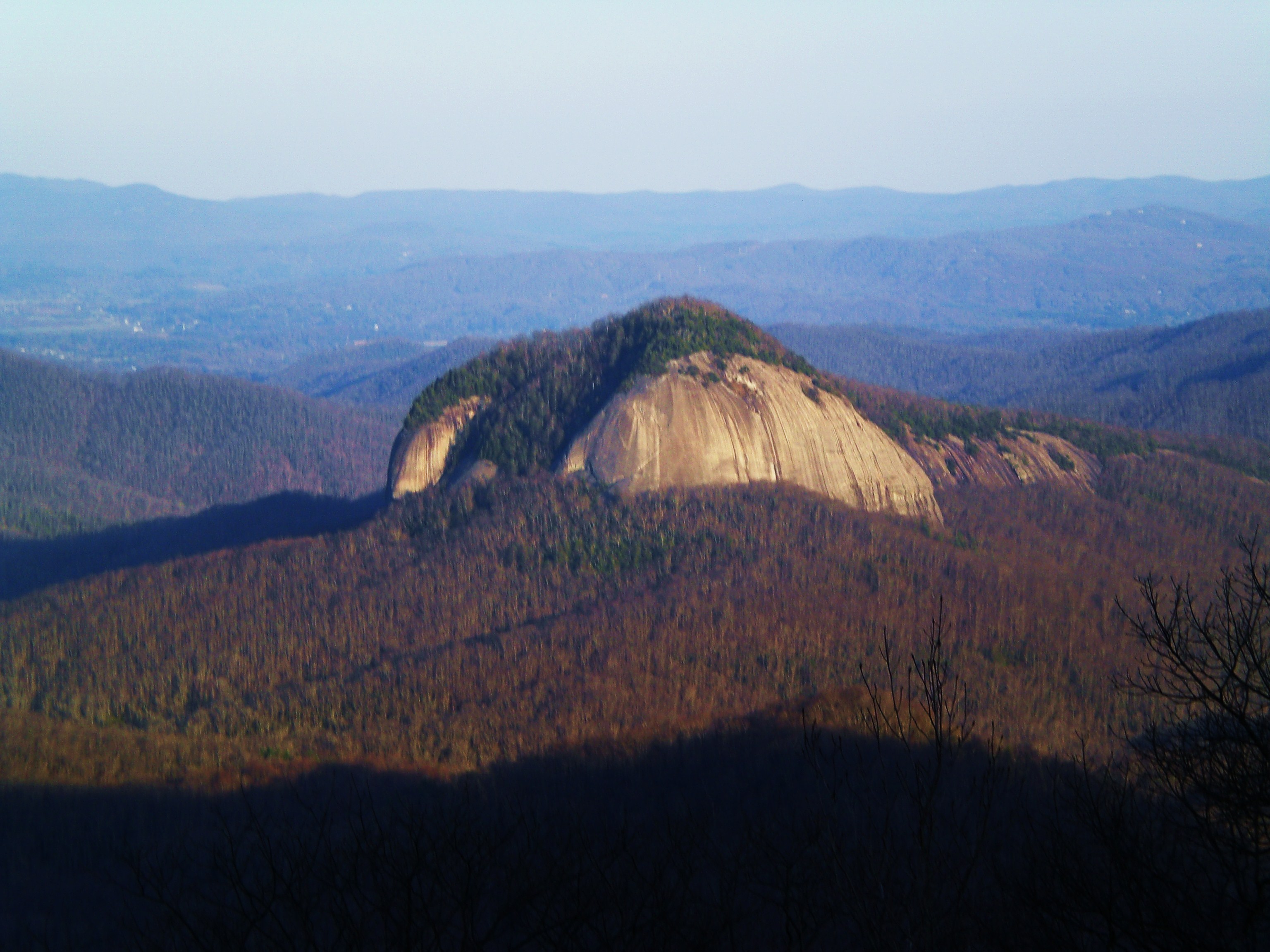
Looking Glass Rock is among the most distinctive summits in western North Carolina, an enormous exposed granite pluton that rises above the forest near Brevard and shines like a mirror when its wet faces catch the sun. The trail to the top is a steady forest climb rather than a scramble, ending at an open rock outcrop with a wide view over Pisgah National Forest. With one of the highest review counts of any hike in the region, it is a genuine local classic, praised for its consistent grade and its rewarding summit ledge.
From the trailhead the path climbs almost immediately and keeps climbing, working up the mountain in a long series of switchbacks through dense hardwood forest. The grade is steady and unrelenting rather than steep in bursts, so the effort is a sustained one, and hikers frequently mention roots and rocky sections underfoot that call for attention on the way up and down. There are no big views for most of the climb, which makes the forest walk feel long until the payoff arrives. The mountain takes its name from that bare rock, which reflects sunlight like a mirror when its wet granite faces catch the light, a shine visible from the Blue Ridge Parkway across the valley.
About two-thirds of the way up, a marked helicopter landing pad painted on the rock signals that the summit area is near. Shortly after, the trail opens onto a broad, sloping expanse of bare granite with a sweeping view south and west over the mountains of Pisgah. This open rock ledge is the destination, and it is where hikers spread out to rest and take in the panorama that makes the long climb worthwhile.
The granite that makes the view so open is also the trail’s main hazard. When wet from rain, fog, or ice, the exposed rock becomes extremely slippery, and slips near the sloping edges are the most serious risk on the hike. Reviews are emphatic that the summit rock should be treated with caution, staying well back from the edges and avoiding the exposed slabs entirely in wet or freezing conditions.
Moderately challenging is a fair rating, with the difficulty being the sustained climb rather than any technical terrain. The trail gains around 1,700 feet over three miles up, which is a solid, continuous effort that most reasonably fit hikers complete in around three to four hours round trip. The rooty, rocky surface adds to the workout, especially on the descent when tired legs meet uneven footing.
Conditions vary with the weather. The trail can be muddy after rain, and the summit granite is the real variable, ranging from perfectly grippy when bone dry to genuinely dangerous when wet or iced. The honest read is a rewarding, workmanlike climb whose main challenge is endurance, with a safety caveat reserved entirely for the exposed rock at the top.
The prime season runs March through November, with fall the standout for crisp air, color across Pisgah, and the clearest long-range views from the summit rock. Spring brings wildflowers and green to the forested climb, and the shade keeps summer hiking tolerable despite the sustained effort, though an early start helps beat both heat and the crowds.
Winter can be beautiful but is the riskiest time, since ice on the summit granite turns the payoff into a hazard, and traction is essential on the upper trail. Note that portions of the rock are sometimes closed seasonally to protect nesting peregrine falcons, so checking for current closures before you go is worthwhile. In any season, a dry, clear day is what makes both the climb safer and the view better.
Parking is the main logistical hurdle. The trailhead lot off the Pisgah Forest roads is small to medium and free, and it fills early on nice weekends, so an early arrival is the reliable strategy. There are limited services nearby, so bring water and anything you need for a half-day hike.
Grippy footwear is genuinely important here, both for the rooty climb and the exposed summit rock, and trekking poles help on the steady descent. Dogs are welcome on leash and many hikers bring them, though the length and the slick summit rock make it a demanding outing for a dog. Carry plenty of water, since there is none on the trail, and pack out everything on this heavily used path.
Looking Glass Rock sits in the heart of the Pisgah Ranger District near Brevard, an area packed with waterfalls and trails, which makes it easy to build a full day around. Its combination of a satisfying climb and a genuinely spectacular summit view has made it a bucket-list hike for the region, as its enormous popularity attests.
Looking Glass Rock earns excellent marks from the huge number of people who hike it, with the overwhelming majority rating it worth the climb and pointing to the open summit ledge as the reward. The steady refrain in trip reports is about the sustained grade and, above all, the slick summit granite, with hikers repeatedly urging caution on the exposed rock.
That is the honest summary of this Pisgah classic. It is a long, steady climb to a genuinely dramatic granite summit, rewarding for the effort as long as you respect the exposed rock at the top. Come early for parking, wear grippy shoes, pick a dry day, and stay back from the edges, and Looking Glass Rock delivers one of the best summit views in western North Carolina.
LOWA Renegade EVO GTX MidGORE-TEX, 3 widths, resolableCheck price on Amazon →Hydro Flask Wide Mouth 32ozinsulated, durableCheck price on Amazon →Osprey Talon 22ventilated back, pole carryCheck price on Amazon →Adventure Medical Kits Ultralight Watertight .7day-hike specific, waterproofCheck price on Amazon →Black Diamond Spot 400-Rrechargeable, comfortableCheck price on Amazon → Patagonia Torrentshell 3L Jacketdurable, trail + everydayCheck price on Amazon →
 Darn Tough Hiker Micro Crew Midweightlifetime warrantyCheck price on Amazon →
 Black Diamond Pursuit Trekking Polescork grip, lightweightCheck price on Amazon →
 Sawyer Squeeze Water Filterultralight, standard threadsCheck price on Amazon →


