LOWA Renegade EVO GTX MidGORE-TEX, 3 widths, resolableCheck price on Amazon →
 Hydro Flask Wide Mouth 32ozinsulated, durableCheck price on Amazon →
 Osprey Talon 22ventilated back, pole carryCheck price on Amazon →
 Adventure Medical Kits Ultralight Watertight .7day-hike specific, waterproofCheck price on Amazon →
 Black Diamond Spot 400-Rrechargeable, comfortableCheck price on Amazon →
What to Expect
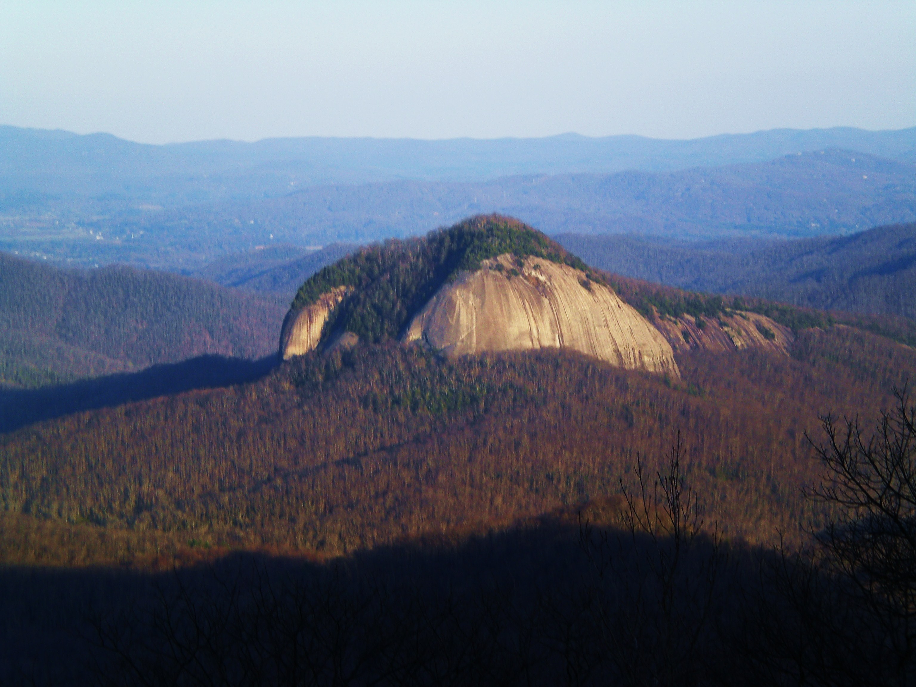
John Rock gives you something Looking Glass doesn’t: a view of Looking Glass Rock from across the drainage, which turns out to be excellent. The two granite domes face each other over the Davidson River valley, and from John Rock’s summit you can watch clouds move across the bare face of its more famous neighbor while standing on your own exposed ledge with almost no one around. That relative solitude is the main reason to choose John Rock.
The standard approach is a 4.6-mile loop starting from the Pisgah Center for Wildlife Education on Fish Hatchery Road. The first half follows Cat Gap Loop through dense forest with stream crossings — the creek crossings can be tricky in spring when water is high, and there are no bridges. The climb to the rock face comes in the back half of the loop, fairly steep for about half a mile before you emerge onto the open ledge. The summit itself is a long angled slab with several good sitting spots and clear sight lines west toward Pisgah Ridge.
The loop format means you’re not retracing steps, which makes it feel more like an adventure and less like a workout. The forest on the lower section has some impressive old hemlocks and the understory is thick in spring. Overall this is one of the better moderate hikes in Pisgah — harder than it looks on paper due to the creek crossings and summit pitch, but the payoff is real.
Difficulty
Strenuous, trending toward the upper end of moderate. The 4.6-mile loop has 1,200 feet of gain concentrated in the final climb to the summit. The creek crossings on Cat Gap Loop can complicate things in wet conditions. The exposed rock at the top requires the same caution as Looking Glass — stay off it when wet. Fit hikers complete the loop in 2.5 hours; 3.5 is a more realistic target if you spend time on the summit.
Best Time to Go
Spring wildflower season — late March through April — is outstanding on the lower trail through the forest sections. Fall color is excellent, with the open summit giving you a view of the color change across the valley. Summer mornings work if you’re moving by 8 or 9 AM before heat builds. The creek crossings make this one problematic after heavy rain; check conditions if there’s been precipitation in the previous 48 hours.
Before You Go
Park at the Pisgah Center for Wildlife Education on Fish Hatchery Road, off US-276 about 5 miles from the Blue Ridge Parkway. Free parking, restrooms available at the trailhead during wildlife center hours. The trailhead is clearly signed. About 35 miles from Asheville, roughly the same drive as Looking Glass Rock. No fee. Cell service is minimal on the upper trail. Water crossings mean you’ll likely get your feet wet in spring — plan accordingly.
Frequently Asked Questions
LOWA Renegade EVO GTX MidGORE-TEX, 3 widths, resolableCheck price on Amazon →Hydro Flask Wide Mouth 32ozinsulated, durableCheck price on Amazon →Osprey Talon 22ventilated back, pole carryCheck price on Amazon →Adventure Medical Kits Ultralight Watertight .7day-hike specific, waterproofCheck price on Amazon →Black Diamond Spot 400-Rrechargeable, comfortableCheck price on Amazon → Patagonia Torrentshell 3L Jacketdurable, trail + everydayCheck price on Amazon →
 Darn Tough Hiker Micro Crew Midweightlifetime warrantyCheck price on Amazon →
 Black Diamond Pursuit Trekking Polescork grip, lightweightCheck price on Amazon →
 Sawyer Squeeze Water Filterultralight, standard threadsCheck price on Amazon →