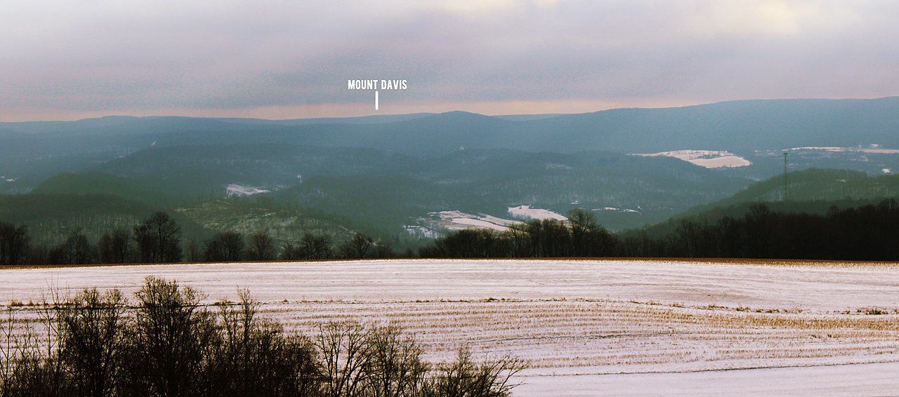
High Rock Fire Tower — South Savage Mountain
Photo: Grendelkhan
(CC via Wikimedia)
 LOWA Renegade EVO GTX MidGORE-TEX, 3 widths, resolableCheck price on Amazon →
 Hydro Flask Wide Mouth 32ozinsulated, durableCheck price on Amazon →
 Osprey Talon 22ventilated back, pole carryCheck price on Amazon →
 Adventure Medical Kits Ultralight Watertight .7day-hike specific, waterproofCheck price on Amazon →
 Black Diamond Spot 400-Rrechargeable, comfortableCheck price on Amazon →
High Rock Fire Tower at a glance: A 2-mile round trip on Big Savage Mountain to the 2,970-foot summit and a restored fire tower with views over the Appalachian ridges at the Maryland-Pennsylvania border. Officially easy, with a steady grade on old logging-road tread. The hardest part is finding the unmarked trailhead.
High Rock Fire Tower is one of the western Maryland hikes that locals know about and almost nobody else does. The 2-mile round trip climbs a former logging road through Savage River State Forest to a restored fire tower with a 360° view across the Appalachian ridges. The trail is short, the climb is steady, and the trailhead is the kind of unmarked dirt pullout that has confused first-time visitors since the tower was built.
The route follows the Big Savage Trail, the white-blazed long-distance ridge trail that traverses South Savage Mountain across western Maryland. From the unmarked trailhead off Pine Swamp Road, the trail climbs steadily through mixed hardwood forest on what was originally an old logging or fire road wide enough for vehicles. The first quarter mile crosses a swampy section that holds water through most of the year; bog boards or rock steps make the crossing manageable in dry conditions and a slosh after rain.
After the swamp, the road grade kicks in and the climb is steady for most of the next mile. The forest stays mostly shaded, with hardwoods giving way to scattered pine and rhododendron higher on the ridge. The trail is wide enough that two hikers can walk side by side most of the way, and the footing is the standard western Maryland mix of packed dirt, rocks, and occasional small water bars.
The summit at 2,970 feet is the high point of South Savage Mountain. The restored fire tower rises about 90 feet above the ridge, with a metal staircase to the cab and an open observation platform. The view stretches north into Pennsylvania across the patchwork of forest and farmland, west into the Allegheny backbone toward the Eastern Continental Divide, and east toward Frostburg and the lower Cumberland valley. Hikers consistently describe the view as larger than the elevation suggests, since the ridge sits prominently above the surrounding country.
Officially easy, and the actual hike lives up to that rating with one caveat: the grade is steady enough that hikers regularly push it toward “easy to moderate.” The 600 feet of climbing over 1 mile is distributed without flat reprieves, and the road grade does not switchback. Trail runners and fast hikers reach the tower in about 30 minutes; most casual hikers complete the round trip in 90 minutes including tower time.
The tread itself is forgiving. The road surface is wide and well-maintained, the rocky sections are short, and the swampy lower stretch is the only place where wet weather genuinely complicates the walk. Kids and dogs handle the route well, with the wide trail surface making it a popular family choice in the area.
Mid-October delivers the standout window. The Allegheny ridges turn earlier than peak Shenandoah color, and the long views from the tower into Pennsylvania and northern West Virginia hit hardest when the leaves are at peak. Late September into early November is the reliable color window for western Maryland.
Late spring brings the bug pressure. Mosquitos and gnats are heavy through May and June, and ticks are a real concern from spring through fall. Summer is hot and humid in the lower trail, though the shaded canopy keeps the tower climb tolerable. Winter is the quiet season. The road grade holds snow well, and the trail becomes a popular cross-country ski route after major storms.
Finding the trailhead is the most common navigation issue at High Rock. The pullout sits off Pine Swamp Road south of Frostburg, and there is no signage at the road. Approach from Westernport Road to the south or from the New Germany State Park area to the east; both routes connect to Pine Swamp Road and reach the same unmarked pullout. GPS coordinates are the reliable input. Confirm them before driving in because cell service drops well before the trailhead.
There are no bathrooms at the trailhead, no water, and no facilities anywhere on the trail. Frostburg about 30 minutes east has gas, restaurants, and a small grocery; Oakland to the west is similar. The trail is approximately 3 hours from Washington DC via I-68 west, and the high-elevation western Maryland setting makes a logical anchor for a weekend that includes Swallow Falls State Park or the Savage River trails.
Free parking. No fee for trail use. The Savage River State Forest is open year-round with no entry gate.
Hikers tackling more than a short visit should pack water, snacks, and a paper map of the Savage River State Forest trail system. The Big Savage Trail extends well beyond High Rock in both directions, and connectors lead to the Eastern Continental Divide Trail and the Savage River reservoir.
High Rock Fire Tower is the rare western Maryland summit that delivers a real Appalachian panorama with a short climb. Hikers consistently describe the tower view as the standout, with the long sightlines into Pennsylvania and the Alleghenies pulling more weight than the modest distance and elevation suggest. The restored steel tower is the structural reason for the visit; the surrounding ridge would be a wooded summit without it.
The route is also the rare fire tower hike where the trailhead navigation is the toughest part. Once hikers find the unmarked pullout, the route is straightforward and the climb is steady. For DC-area visitors who have not spent time in the western Maryland panhandle, High Rock pairs well with Swallow Falls State Park (35 minutes south for waterfalls) or with the Savage River reservoir trails for a longer weekend. The drive to western Maryland feels long from DC, but the combination of the tower view and the quieter trail experience is the regional reason this corner of the state stays on the radar.
LOWA Renegade EVO GTX MidGORE-TEX, 3 widths, resolableCheck price on Amazon →Hydro Flask Wide Mouth 32ozinsulated, durableCheck price on Amazon →Osprey Talon 22ventilated back, pole carryCheck price on Amazon →Adventure Medical Kits Ultralight Watertight .7day-hike specific, waterproofCheck price on Amazon →Black Diamond Spot 400-Rrechargeable, comfortableCheck price on Amazon → Patagonia Torrentshell 3L Jacketdurable, trail + everydayCheck price on Amazon →
 Darn Tough Hiker Micro Crew Midweightlifetime warrantyCheck price on Amazon →
 Black Diamond Pursuit Trekking Polescork grip, lightweightCheck price on Amazon →
 Sawyer Squeeze Water Filterultralight, standard threadsCheck price on Amazon →