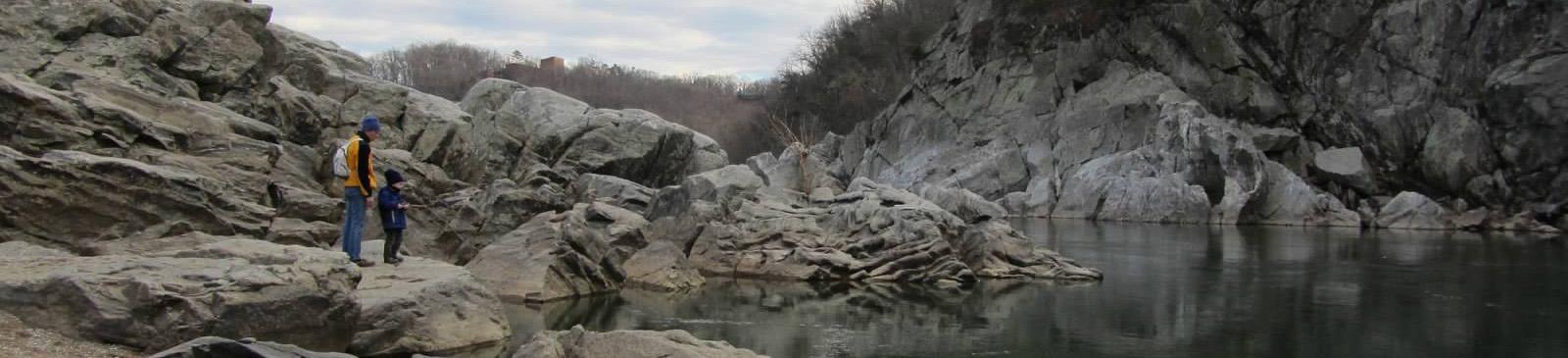
Annapolis Rock — South Mountain
Photo: Joe Calzarette
(CC via Wikimedia)
 LOWA Renegade EVO GTX MidGORE-TEX, 3 widths, resolableCheck price on Amazon →
 Hydro Flask Wide Mouth 32ozinsulated, durableCheck price on Amazon →
 Osprey Talon 22ventilated back, pole carryCheck price on Amazon →
 Adventure Medical Kits Ultralight Watertight .7day-hike specific, waterproofCheck price on Amazon →
 Black Diamond Spot 400-Rrechargeable, comfortableCheck price on Amazon →
Annapolis Rock at a glance: A 5.1-mile out-and-back on the Appalachian Trail near Boonsboro, climbing South Mountain to a cliff-top overlook above Greenbrier Lake and the valley. Rated moderate, with a steady but manageable climb and a well-maintained, dog-friendly path. It is one of Maryland’s most popular hikes, so the parking lot off US 40 fills early, and the overlook and its backcountry campsite draw steady crowds on weekends.
Annapolis Rock is Maryland’s go-to Appalachian Trail day hike, a moderate climb to a dramatic quartzite cliff with a wide view over the valley and Greenbrier Lake. It delivers a classic ridge overlook without the punishing effort of a big mountain, which is exactly why it draws so many hikers. Reviews rate it highly for the payoff-to-effort ratio, with the main caveats being weekend crowds and a parking lot that fills fast.
The hike follows the Appalachian Trail north from the US 40 trailhead, climbing steadily along the wooded spine of South Mountain. The first stretch is the main work of the day, a gentle to moderate grade that gains the ridge without any severe pitches. Once on top, the trail levels into an easy ridge walk through hardwood forest, well graded and well trodden from heavy use.
A short blue-blazed spur leads off the AT to the Annapolis Rock overlook itself. Here the forest opens onto a broad quartzite outcrop with a sweeping westward view over Greenbrier Lake and the Cumberland Valley, the highlight that draws hikers up in the first place. Many hikers extend the trip about a mile farther north on the Appalachian Trail to Black Rock, a second and usually quieter overlook with an even wider panorama, which adds roughly two miles round trip to the day. The cliffs here are also a well-known local rock-climbing spot, so it is common to see climbers working the walls below the overlook. The outcrop faces west, which makes it a rewarding place to catch the sunset, though hikers staying that late should carry a headlamp for the walk back down through the woods.
There is a designated backcountry campsite near the overlook, complete with a seasonal caretaker and tent pads, which makes Annapolis Rock a popular first backpacking trip as well as a day hike. That mix of day hikers, campers, and climbers gives the overlook a social, busy feel on nice weekends rather than a remote-summit solitude.
Moderate is a fair rating, leaning toward the easier end for a five-mile hike. The climb to the ridge is steady but not steep, and once you are up top the walking is easy, so most reasonably active hikers and families handle it comfortably in around two to two and a half hours round trip. It is a good choice for newer hikers ready to step up from a flat walk.
The trail is well maintained, which keeps the footing straightforward, though the lower climb can be muddy after rain and there are a few rocky and stepped sections. The honest read is an accessible, rewarding hike whose main challenges are logistical, namely parking and crowds, rather than physical. Adding the Black Rock extension bumps up the distance and elevation a little without changing the fundamentally moderate, accessible character of the hike, which is why it suits newer hikers looking to build mileage.
The trail is open year-round and works in every season. Spring and fall are the highlights, with comfortable temperatures and, in autumn, excellent color across the valley from the overlook. Summer is green and shady on the ridge but busy, so an early start helps with both heat and parking. Winter brings bare-tree long views and a quieter trail, with the occasional need for traction after snow or ice.
Regardless of season, weekends are the busy time, and the overlook can be crowded midday. Hikers who arrive early in the morning report a quieter trail, an easier parking situation, and the overlook closer to themselves, which is the consistent recipe for enjoying Annapolis Rock at its best.
Parking is the main planning concern. The trailhead lot off US 40 is free but fills early on weekends, and hikers repeatedly stress arriving in the morning to get a spot rather than circling or parking unsafely along the highway. There are no services at the trailhead, so bring water and anything you need for the hike.
Dogs are welcome on leash and this is a favorite among local dog owners, so expect plenty of canine company. If you plan to camp, the sites near the overlook are first-come and popular, so have a backup plan on busy weekends. A spring near the campsite supplies water for backpackers, though it should be filtered or treated before drinking and can run low in dry spells. Standard Leave No Trace practices matter here given the heavy use, and packing out trash keeps the overlook pleasant for everyone.
Annapolis Rock sits along South Mountain near Boonsboro, within easy reach of both the Baltimore-Washington area and the Frederick region, which is a big part of why it is so heavily used. Its blend of an accessible AT climb, a genuine cliff overlook, and a beginner-friendly campsite makes it a versatile pick for a wide range of hikers.
Annapolis Rock earns strong marks from the large number of people who hike it, with the majority praising the overlook view and the easy-to-moderate climb that gets you there. The recurring practical advice is simple and consistent: come early for parking, expect company at the overlook, and keep dogs leashed on this busy, family-friendly trail.
That is the fair summary of Maryland’s most popular AT day hike. It offers a genuine cliff-top view for a moderate, accessible effort, which is exactly why it stays so busy. Arrive early, bring water, and plan around the crowds, and Annapolis Rock delivers one of the best overlook payoffs in the state for the effort involved.
LOWA Renegade EVO GTX MidGORE-TEX, 3 widths, resolableCheck price on Amazon →Hydro Flask Wide Mouth 32ozinsulated, durableCheck price on Amazon →Osprey Talon 22ventilated back, pole carryCheck price on Amazon →Adventure Medical Kits Ultralight Watertight .7day-hike specific, waterproofCheck price on Amazon →Black Diamond Spot 400-Rrechargeable, comfortableCheck price on Amazon → Patagonia Torrentshell 3L Jacketdurable, trail + everydayCheck price on Amazon →
 Darn Tough Hiker Micro Crew Midweightlifetime warrantyCheck price on Amazon →
 Black Diamond Pursuit Trekking Polescork grip, lightweightCheck price on Amazon →
 Sawyer Squeeze Water Filterultralight, standard threadsCheck price on Amazon →