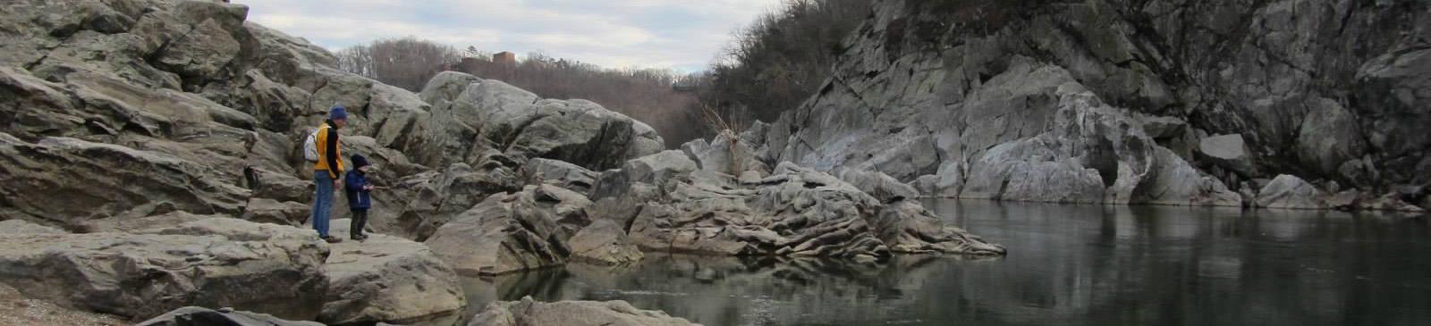
Sugarloaf Mountain — Stronghold Nature Preserve
Photo: TheTurducken
(CC via Wikimedia)
 LOWA Renegade EVO GTX MidGORE-TEX, 3 widths, resolableCheck price on Amazon →
 Hydro Flask Wide Mouth 32ozinsulated, durableCheck price on Amazon →
 Osprey Talon 22ventilated back, pole carryCheck price on Amazon →
 Adventure Medical Kits Ultralight Watertight .7day-hike specific, waterproofCheck price on Amazon →
 Black Diamond Spot 400-Rrechargeable, comfortableCheck price on Amazon →
Sugarloaf Mountain Northern Peaks at a glance: A 6.9-mile loop near Barnesville that links Sugarloaf’s summit with the rocky Northern Peaks Trail for a fuller day than the short summit walk. Rated moderate, with rocky footing and several short climbs that add up to a real workout. The mountain is a privately owned preserve that is free to visit but keeps its own hours, so check access, arrive early, and wear grippy shoes for the rock.
Sugarloaf Mountain rises on its own from the Maryland piedmont, an isolated monadnock, a lone erosion-resistant quartzite knob left standing above the softer land around it, that offers far more hiking than its modest height suggests. At around 1,280 feet it is not tall, but its abrupt rise gives the overlooks a bigger sense of height than the elevation implies. While many visitors drive most of the way up and take the short summit path, the Northern Peaks Trail turns Sugarloaf into a satisfying loop over rocky ridges and quieter overlooks. Hikers rate the longer route highly for the workout and the variety, with the main notes being rocky footing and a trail network that rewards paying attention to the blazes.
The Northern Peaks loop combines several of the mountain’s color-blazed trails, typically linking the white-blazed Northern Peaks Trail with the blue-blazed Sugarloaf trails to form a circuit. From the parking areas the route climbs to the main summit, where overlooks give wide views over the surrounding farmland and piedmont, then continues north over a series of lower rocky peaks that most drive-up visitors never see. That quieter northern stretch is where the loop earns both its length and its sense of solitude, well away from the crowded main overlook.
The character of the hike is rocky and rolling. Rather than one big climb, the loop delivers a sequence of short, steep ups and downs over rocky terrain, with several overlooks along the way including the well-known West View and East View points. These rocky outcrops look out in different directions, so on a clear day the loop lets you catch both morning and afternoon light over the piedmont from the same mountain. Hikers frequently describe it as a genuine workout precisely because of this repeated up-and-down rather than any single long ascent.
Because the mountain has a dense web of interconnecting trails, navigation deserves attention. The trails are blazed and generally well marked, but the junctions come frequently, and hikers note it is easy to piece together a different loop than intended if you miss a turn. A map or a downloaded route keeps the day on track and makes the most of the network.
Moderate is a fair rating, with the difficulty coming from footing and cumulative climbing rather than elevation. The rocky trail surface is the thing hikers mention most, and it slows the pace and demands attention, especially on the descents. Most hikers complete the loop in around three to three and a half hours, and treat it as a solid half-day outing rather than a quick summit stroll.
The rock can be slick when wet, so shoes with good grip help, and the repeated climbs make it more tiring than the mileage implies. The honest read is an accessible but genuinely rewarding loop that gives a real sense of a hike, which is why it is popular with locals looking to train or simply get more out of the mountain than the summit overlook alone.
Sugarloaf is open year-round and rewards visits in every season. Fall is the standout, when the overlooks frame color across the piedmont and the crisp air stretches the views. Spring brings green and wildflowers, while summer is shady on the wooded sections but can be humid, making an early start worthwhile. Winter offers bare-tree long views and a quieter mountain, with traction useful on the rocky sections after snow or ice.
Because the mountain is a private preserve, it keeps set opening hours and can close for weather or events, so a quick check of current access before you go is smart. Weekends draw crowds to the summit and main overlooks, though the Northern Peaks section stays quieter, and an early arrival helps with both parking and solitude.
Sugarloaf Mountain is privately owned and operated as a preserve that is free to visit but keeps its own hours and rules, so confirm it is open before making the trip. There are several parking areas at different elevations, including lots near the base and partway up, with restrooms available, and they fill on nice weekends, so arrive early.
Dogs are welcome on leash and the mountain is a popular dog-walking spot, so expect company. Wear sturdy shoes with grip for the rocky trail, carry water since there is none along the loop, and bring a map given how many trail junctions you will pass. As a private preserve, it relies on visitors following its rules and Leave No Trace practices to stay open and welcoming.
Sugarloaf sits near Barnesville, within easy reach of the Washington and Frederick areas, which makes it a convenient outing rather than a remote trek. Its blend of an accessible summit for casual visitors and a rockier Northern Peaks loop for those wanting more makes it a versatile destination for mixed-ability groups.
Sugarloaf’s Northern Peaks loop earns solid marks from the people who hike it, with the majority praising the workout, the overlooks, and the quieter terrain beyond the main summit. The recurring practical notes are about the rocky footing, the frequent trail junctions, and checking the preserve’s hours before you go.
That is the fair summary of the fuller way to experience Sugarloaf. It turns a short summit visit into a genuine half-day loop with real climbing and rewarding views, all on a mountain that rises surprisingly from the flat piedmont. Confirm access, arrive early, wear grippy shoes, and follow the blazes, and the Northern Peaks loop delivers a satisfying outing well beyond the drive-up overlook.
LOWA Renegade EVO GTX MidGORE-TEX, 3 widths, resolableCheck price on Amazon →Hydro Flask Wide Mouth 32ozinsulated, durableCheck price on Amazon →Osprey Talon 22ventilated back, pole carryCheck price on Amazon →Adventure Medical Kits Ultralight Watertight .7day-hike specific, waterproofCheck price on Amazon →Black Diamond Spot 400-Rrechargeable, comfortableCheck price on Amazon → Patagonia Torrentshell 3L Jacketdurable, trail + everydayCheck price on Amazon →
 Darn Tough Hiker Micro Crew Midweightlifetime warrantyCheck price on Amazon →
 Black Diamond Pursuit Trekking Polescork grip, lightweightCheck price on Amazon →
 Sawyer Squeeze Water Filterultralight, standard threadsCheck price on Amazon →