 LOWA Renegade EVO GTX MidGORE-TEX, 3 widths, resolableCheck price on Amazon →
 Hydro Flask Wide Mouth 32ozinsulated, durableCheck price on Amazon →
 Osprey Talon 22ventilated back, pole carryCheck price on Amazon →
 Adventure Medical Kits Ultralight Watertight .7day-hike specific, waterproofCheck price on Amazon →
 Black Diamond Spot 400-Rrechargeable, comfortableCheck price on Amazon →
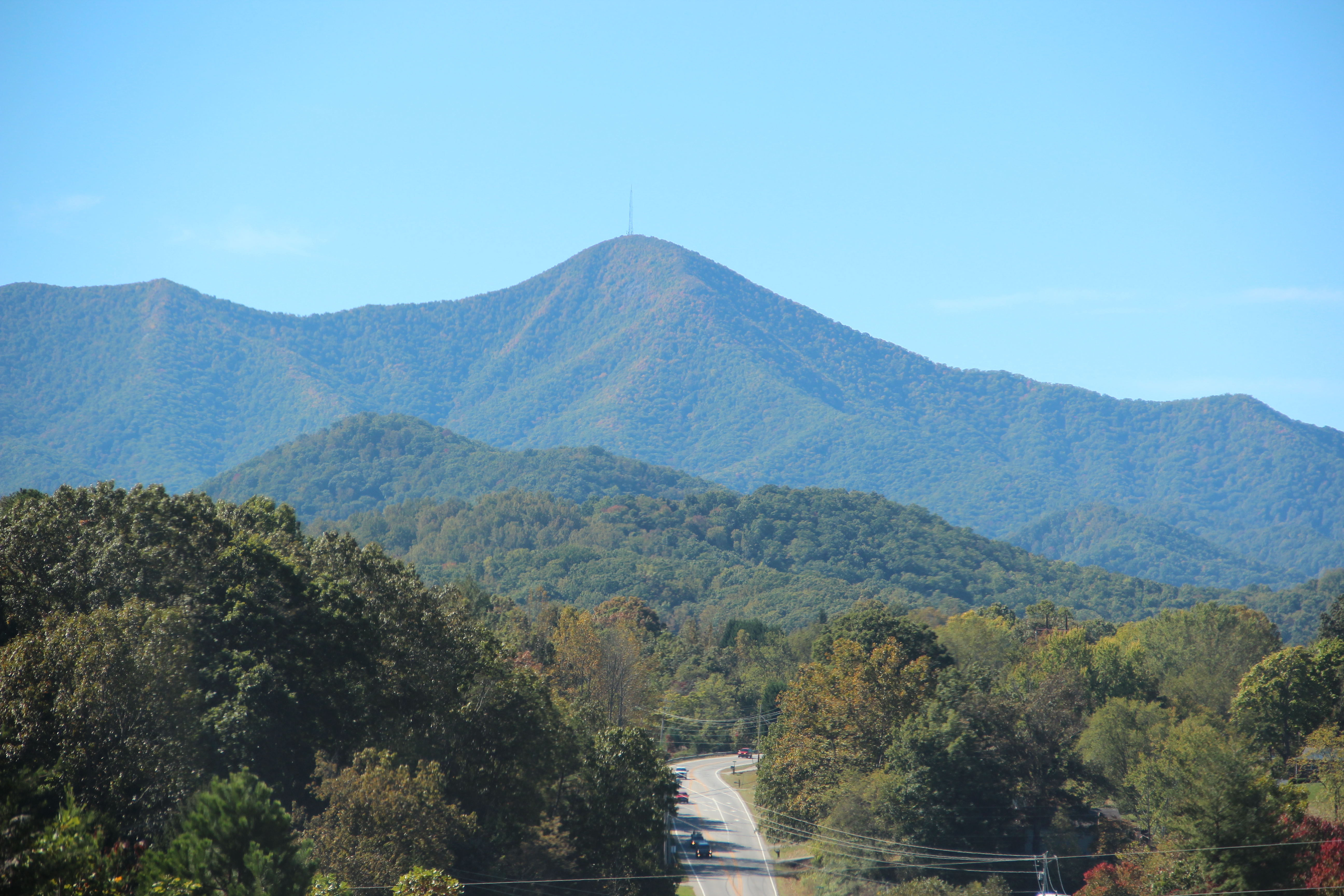
Mount Pisgah is one of those mountains you can see from downtown Asheville on a clear day — the TV tower on the 5,721-foot summit is a local landmark. The trail from the BRP parking area at milepost 408.6 is a straight shot up: 1.5 miles of forested trail gaining 700 feet to the summit. Most of the climb is through dense hardwood and Fraser fir forest with occasional rocky sections. Near the top, the forest opens slightly and the TV tower infrastructure becomes visible before you reach the actual summit clearing.
The summit itself doesn’t have a traditional overlook — the TV tower takes up most of the high point — but the surrounding forest gives way to partial views north and west across the Pisgah National Forest. The Pisgah Inn is half a mile back at the trailhead, with a restaurant, camp store, and motel rooms. It’s the highest full-service lodging on the entire Blue Ridge Parkway. Getting a burger at the inn after the hike has become a ritual for regulars. The inn is open May through October.
Strenuous for a three-mile round trip. The 700-foot gain is concentrated — the trail doesn’t waste time on flat sections. The upper portion is steep with rooted, rocky terrain that demands attention on the way down. It’s not a scramble, but it’s also not a walk. The elevation (approaching 6,000 feet at the top) can make the effort feel harder than the mileage suggests for hikers coming from lower elevations. Most fit adults complete the round trip in two to three hours without rushing.
Late September and October for fall color, with the surrounding national forest canopy at its peak. The summit location means you’re looking down on the colors rather than into them, which is its own kind of view. Summer hiking here is comfortable due to the elevation. The Pisgah Inn season runs May through October, so the food option goes away outside those months. The parkway near milepost 408 occasionally closes for ice and snow in winter. Check NPS road conditions before driving out November through March.
The Mount Pisgah Trailhead parking is off the parkway at milepost 408.6, roughly 26 miles from Asheville. Free parking, no permit. Restrooms are available at the Pisgah Inn area nearby. The inn restaurant is open May through October — worth timing your hike around if you want a meal. Cell service is minimal on the trail and summit. Bring water; no sources on the trail. Dogs on leash are allowed. The trail is well-maintained and clearly marked from the parking area — follow the white blazes from the sign.
LOWA Renegade EVO GTX MidGORE-TEX, 3 widths, resolableCheck price on Amazon →Hydro Flask Wide Mouth 32ozinsulated, durableCheck price on Amazon →Osprey Talon 22ventilated back, pole carryCheck price on Amazon →Adventure Medical Kits Ultralight Watertight .7day-hike specific, waterproofCheck price on Amazon →Black Diamond Spot 400-Rrechargeable, comfortableCheck price on Amazon → Patagonia Torrentshell 3L Jacketdurable, trail + everydayCheck price on Amazon →
 Darn Tough Hiker Micro Crew Midweightlifetime warrantyCheck price on Amazon →
 Black Diamond Pursuit Trekking Polescork grip, lightweightCheck price on Amazon →
 Sawyer Squeeze Water Filterultralight, standard threadsCheck price on Amazon →